PASIG 2016 talk
This serves as a placeholder for the talk I will be giving at PASIG later this week. The talk will be posted after I deliver it, since I have a tendency to revise all the way up to walking to the lectern.
This serves as a placeholder for the talk I will be giving at PASIG later this week. The talk will be posted after I deliver it, since I have a tendency to revise all the way up to walking to the lectern.
As America’s longest presidential election finally gets underway (particularly in the 34 states that have early voting), and as a voter in the great swing state of Ohio, I have started to think that the best metaphor for voting in this election is that of the social responsibility of mass vaccination. In order to be clear about my personal views, I believe this election is between an experienced politician with profound shortcomings [1], but who fundamentally understands the three branches of government, the interrelationships between local, state, and federal governance, and what the Constitution does and does not allow a President to do. In contrast, her opponent is a man who has never been elected to public office before, or ever served in any civilian or military public service, who exploits frightening bigotry, and who has shown very little understanding of the functions of governance or the Constitution.[2]
During this election cycle, and particularly in Ohio, there has been a lot of grumbling along the lines of “Both candidates are terrible, so I am going to stay home or vote third-party, because neither one reflects my views.” I am distressed by this idea, because it suggests that voting is a personal act, or a personal expression of one’s views. From where I stand, we need to think of voting as a collective action, because it is not an individual act for which one reaps individually allocated benefits or drawbacks (note: this may have been different during Gilded Age machine politics when you could literally get paid for voting for a particular candidate or party). And like any collective action, whether it’s union membership approving a new contract, or an activist group deciding strategies for protest, there is inevitably an evaluation that comes down to: “this contract or action is not going to meet the needs of everyone, but do we think the larger gains that could be realized outweigh the parts that we have discomfort with?”
In the 2016 general election, a terrifying amount is on the line.[3] We have now gone over 8 months without any visible movement towards confirming a new Supreme Court justice, leaving the court with only 8 members. Of the current membership, three of the members are currently over the age of 75 (Kennedy, Breyer and Ginsburg), which means that the chances are pretty good that a second, or even third court vacancy will occur during the next presidential term. Few decisions at the federal level have the potential to shape the American experience more than what comes out of the Supreme Court – Plessy v. Ferguson, which institutionalized racial discrimination, was the law of the land for 58 years before being overturned by Brown v. Board of Education. And this is precisely why the top brass of the GOP keeps gritting their teeth and has taken only the feeblest steps to publicly disavow Trump – because they know that if they are able to control the Supreme Court membership, this is likely their last chance to embed right-wing values into the country’s long-term legal infrastructure, even as the rest of the country is in the midst of a massive political realignment.
To return to my original metaphor – voting is best thought of as not a personal expression of your values, but as a collective action you take on behalf of a larger group. And I think an apt comparison is that of mass vaccination.[4]
Mass vaccination has been one of the most breathtakingly successful ways in which we’ve reduced devastating disease and illnesses that used to routinely strike fear into populations – even within well-developed countries like the US (if you’re young and have never asked an older person what it was like before the polio vaccine – ask. You’ll probably hear some heartbreaking stories about kids they knew who were paralyzed or died). Mass vaccination works because of what is known as herd immunity. In any given population, there are members of the population who cannot receive vaccines, because they may be immunocompromised, or have a potentially deadly allergic reaction to the vaccine ingredients. Therefore, they rely on the rest of us to close off potential entry points for the disease to get into the population. When diseases that were long-thought eradicated pop back up, it’s often because vaccination levels have dropped below a certain threshold. This is dangerous not only for those who could be vaccinated but were not, but especially for those who cannot get vaccinated at all.
Part of the problem with those who decide not to vaccinate against all the advice of the medical and public health communities is that they view this as a personal choice, and not a critical thing they must do for the benefit and health of all. Those who choose not to vaccinate for personal reasons (anti-vaxxers) because of a perceived risk of vaccination are not entirely wrong – any vaccination does have a non-zero risk of side effects. However, the benefits (individually and collectively) of participating in mass vaccination is so overwhelming compared to the risks, that when an increasing number of people prioritize the infinitesimal unlikely personal risk over the overwhelmingly certain public benefit, everyone suffers.
As long as herd immunity thresholds are high enough, anti-vaxxers effectively become free riders. They get to have their cake (benefit from herd immunity) and eat it too (continue to indulge their personal beliefs about vaccination risks). It’s here that I see the most parallels to those who would rather sit this election out, or cast a vote for a third-party candidate, than to grit their teeth and vote for Hillary Clinton.
Like a single vote, a single vaccination is not sufficient to protect one against illness – a disease may mutate and still infect you, or the vaccine may only cover the most common strains of a disease, or you may experience side effects of immunization. However, you incur a major risk by choosing not to vaccinate: you’re rolling the dice that your participation is so marginal that it won’t affect herd immunity, and that the risks of your actions won’t bring about something far worse than you could have imagined, particularly for those who cannot receive a vaccination because of medical reasons.
Let’s look first at the effects of individual actions on a collective decision, because that’s effectively what both vaccination and voting are. If a certain number of people don’t get vaccinated, the herd immunity drops below a certain threshold, and a disease can re-enter the population. Likewise, if enough people don’t vote for a candidate, another candidate will win. And unless you live somewhere with instant runoff voting or alternative voting mechanisms, it’s generally going to be the candidate who is “first past the post.”
Now let’s take a look at some of Ohio’s recent 4-way polls:
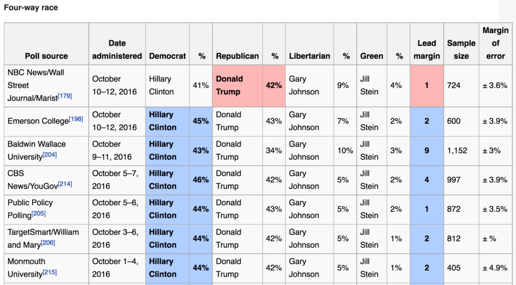
According to my back of the envelope calculations, the combined Johnson and Stein margins are anywhere from 1.4 times (the Baldwin Wallace poll) to 13 times (the NBC News/Wall Street Journal/Marist poll) the margin of difference between Trump and Clinton. This means that if even a small number of third-party voters switched their allegiance to Clinton, it would make her election far more of a sure thing than the extremely tight race depicted above. By choosing to stick with third-party candidates, these voters are effectively withholding a contribution to the only collective action that can prevent a Donald Trump presidency – a vote for Hillary Clinton. Until we have an alternative voting method like instant-runoff voting or proportional voting, a third-party vote, especially in an extremely competitive state like Ohio, is an individual contribution to a collective action that signals “I am OK with the possibility of a Trump presidency.”
Let’s return to the second set of risks when you choose to sit out voting for president, or voting third-party: that the risks of your actions won’t bring about something far worse than you could have imagined. As outlined above, I assume that those voting third-party or sitting this out are indicating by their actions that “both sides are as bad as the other” and that therefore, they truly believe the actual presidencies of each candidate would be indistinguishable. Going back to the vaccination metaphor and herd immunity (which protects those who cannot be immunized), what does this mean for those who cannot vote?
In the American electorate, there are three large populations that are disenfranchised from voting in federal elections. These include children, non-US citizens, and depending on the state, those currently incarcerated or with a felony conviction. Since childhood is a much more straightforward trajectory than citizenship or carceral status, this is why some political scientists distinguish between voting-age population and voting-eligible population.
Many voters in the 2016 general election appear to have become so disgusted by the idea of “voting for two terrible candidates” or “always having to vote for the lesser of two evils” that they plan to vote third-party, or forego voting altogether to register their dissatisfaction. But if we accept the reality that only one of two candidates (Clinton or Trump) will win the election on November 8, we have a moral imperative to select for the least amount of harm for the greatest number of people. I firmly believe that a Trump presidency would be far more devastating for those who are shut out of voting, and therefore the only moral choice is to set aside my political differences with Clinton and vote for her.
Let’s look at this through the lens of climate change. Children have no voice in this election, and yet the actions that the United States takes – or doesn’t take – on climate change in the next few years could make the difference between a grim but adaptable future, and complete horror. These changes are already taking place, and will only accelerate by the time today’s children become part of the voting-eligible population and can legally vote their intent. Until then, we have a moral obligation to ensure that one of only two possible scenarios (Clinton or Trump) is the one that will inflict less damage than the other alternative. Clinton is nowhere near as visionary as she should be on climate change, however she accepts that it is a reality the US must address in cooperation with the rest of the world. Trump, on the other hand, believes that it is a fiction. Which viewpoint has the greater danger of harm for those who cannot currently cast their own vote?
If you truly cannot abide the idea of a Trump presidency, if the idea of Trump governing the United States fills you with horror, then there is only one rational choice you can make if you have voting rights: to vote for Hillary Clinton. Because if you can’t countenance a Trump presidency but you rely on other people to cast the ballot for Clinton you somehow aren’t willing to commit yourself to, you are contributing to a free rider problem: you want to vote your conscience, and let other people do the work of making sure Trump gets nowhere near the levers of power. Which then begs the question: how can you be sure that there aren’t too many others operating on the same mindset as yourself, which could then give Trump the number of votes he needs to be first past the post? Like anti-vaxxers who suddenly find their own children getting measles because too many other parents made the choice not to contribute to herd immunity, those who sit out or cast a third-party vote while fearing a Trump presidency are putting their own interests over the collective good of all.
Perhaps as a voter, you truly believe both a Clinton and Trump presidency would be equally reprehensible. You’re OK with either outcome. You’re willing to roll those dice. In that case, let me reframe the moral question as, “Who would you rather have as your political enemy?” In one of the smartest political commentaries I’ve yet seen on this totally appalling election, British writer Laurie Penny explored this exact question:
I do not expect a president of the United States —or any government leader, for that matter — to be radical. It is not capitulation to be realistic about what can be achieved at the ballot box in a modern democracy, particularly in a presidential election. It is not defeatist to understand that the very most you can hope for is to stop things getting worse as fast as they might otherwise have done. […]
A general election is about nothing more or less than choosing your enemy. Any government leader must be considered an enemy to those who believe in radical change. Hillary Clinton is not yet that enemy but by damn. I hope she gets to be. Hillary Clinton is the sort of enemy I’ve been dreaming of over ten years of political work. She’s the kind of enemy you can respect. I look forward to fighting her on her commitment to climate protection, on workers’ rights, on welfare, on foreign policy. Bring that shit on. That’s the sort of fight I relish. I want to argue over how the state can best serve the interests of women and minorities, not whether it should. That’s the sort of fight that makes me better. Four more years of fighting Donald Trump and his foaming acolytes would demean everyone involved.
My values are such that even though I disagree with Clinton on much, as a politician she is still playing by the same basic principles I expect from a President of the United States: to seek specialist knowledge from diverse experts, to wholly reject exploitation of racial, ethnic, and religious grievances for political gain, and to have previous experience on which to draw. On all of those counts, Donald Trump is an utter and spectacular failure. He routinely rejects the advice of specialists on domestic and foreign affairs. He exploits racial, ethnic, and religious grievances to an alarming degree. Finally, a person who has never served a day in public service, whether political, civil or military, is unfit to become a head of state, which requires an entirely different set of skills from running a for-profit entity.
Every day, normal people suck it up, grit their teeth, and roll up their sleeves for a vaccine. They might not like it, it might hurt for a while, but in the grand scheme of things, they are contributing to collective action that ensures the general well-being of those around us. If you are undecided, thinking about staying home, voting third-party, or a Republican who is leaning towards Trump even if he makes you sick to your stomach, on the eve of this election, I implore you to contribute to our electoral herd immunity. Suck it up, grit your teeth, and vote for Clinton for the general well-being of those around us.
[1] To me, these drawbacks are the standard left-wing criticisms of Clinton. She is too cozy with the wealthy, her climate change proposals are not nearly aggressive enough for what we should have started doing 20 years ago, her record on fracking is not good, and as someone whose job involves public records issues, the private server email business is totally appalling. Finally, my baptism into leftist politics was through protesting the invasion of Iraq in 2003, before I could even vote. If I knew Colin Powell was lying to the UN as a teenager, if I managed to get my slightly conservative Episcopalian church to help fund me to go protest in DC, there is still a part of me that can never quite move on from the fact that Clinton authorized the use of military force in one of the worst follies that has ever taken the lives of thousands of American servicemen and women, and countless lives of Iraqis. All this said, and despite my misgivings, I am early-voting for Clinton soon and even volunteering here and there for her campaign when I have a free hour in my schedule. The alternative of a Trump presidency is simply too horrifying to contemplate.
[2] And it goes without saying, but whose encouragement of his supporters to express and act on similarly bigoted views is beyond the pale.
[3] To be clear, every election is important, and local and state elections often affect your daily life as much, or if not more, than presidential elections. Failure to recognize this on the broad part of the electorate (and the get out the vote efforts of liberal/left political infrastructure) is how we have ended up with Republican-dominated governorships and state legislatures across the United States.
[4] To give credit where it’s due, the herd immunity parallel has popped up a couple times in the epic MetaFilter election threads. I think this might have been the comment that originally lit up this light bulb for me.
Dates: October 8-9, 2016
Weather: Perfect fall hiking weather! Warm but not hot Saturday afternoon, cool in the mornings, and almost chilly overnight.
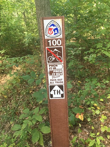
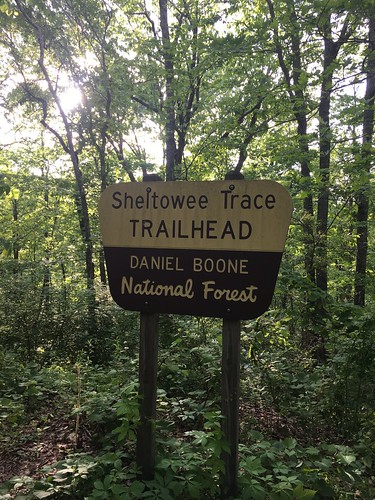
Section: Clear Creek trail head to Morehead, Kentucky (parking lot across the street from the police station)
Miles: Saturday – 18.08 — Gaia GPS, official STA map — 18ish miles (Readers note that new mileage has been added on to the official ST – if you are looking at a current map, it is Trail 1226 between ST miles 40 and 38.5);
Sunday – 9.97 — Gaia GPS, official STA map — 9 miles (Readers note the first dog-leg on the GPS track below is to Limestone Knob, and the second was to attempt to find the lookout at Amburgy Rock). Scroll to bottom to download GPX tracks for your GPS device or app. The miles displayed in the wordpress plugin are different than what the Gaia app says, which is what I list in this top section. You can also visit my Sheltowee Trace folder on GaiaGPS.
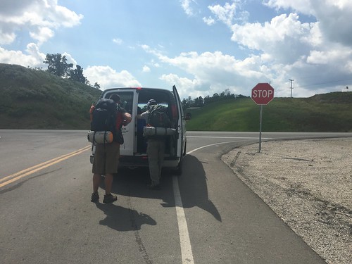
This weekend’s hike started with a valuable lesson – never assume that a campground you’re counting on will have a space when you pull up! Team One was on our own this month for Friday night pre-hike arrangements, so I assumed I could snag a spot at the Twin Knobs campground, only to pull up and find a “campground full” sign at the entrance. To make a long story short, I ended up snagging one of the last few hotel rooms in Morehead, at the Comfort Inn (2650 Ky 801 North) a couple miles away that had just a booking cancellation pop up. I’m eternally grateful to the hotel staff for squeezing me in. It felt a bit like cheating to get a hotel room the night before, but I wasn’t sure if my fellow hikers made it to the other campground (Clear Creek), and since it has no cell phone service, I felt a bit uneasy about that prospect since I was on my own this month.
I brought the stove back this month, along with a bit more weight in food and insulation. I don’t think I added more than a couple pounds of pack weight, and we had gorgeous weather, but for some reason Saturday’s hike was really difficult for me. Apparently I wasn’t the only one – lots of other hikers mentioned the same thing.
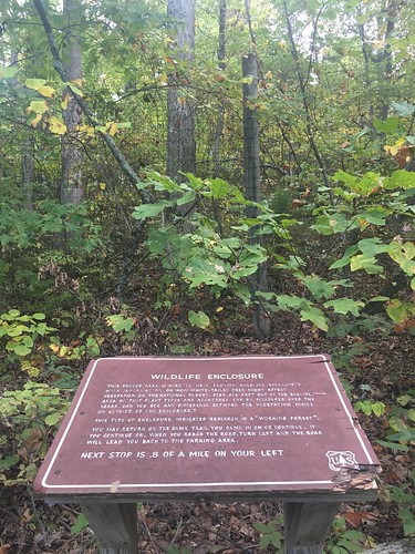
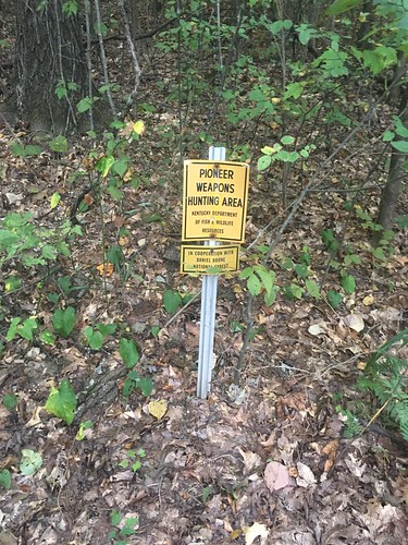
Signs of hunting season have begun to pop up near the trail, especially since this section goes through a pioneer weapons hunting area. At one trail junction, I was hiking by myself, and as I looked to see what the marker on the non-ST trail said, I heard a disembodied voice out of nowhere say quietly, “Ma’am, are you looking for your party?” I looked around, and couldn’t see anyone, and began to freak out – until I looked up and saw a hunter in a tree-stand in full camo (no blaze orange on him). All I could think to reply was “Oh, hi! You are very well camouflaged!” I headed on down the trail and saw a couple other guys in tree stands (visible from far away since they were using blaze orange gear).
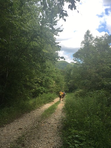
Later on, a group of 6 horseback riders passed on the trail. Many of the ST trails are also used by horseback riders, but this was the first time I had actually encountered any. They went much faster than I thought – impressive!
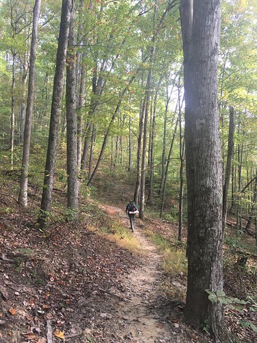
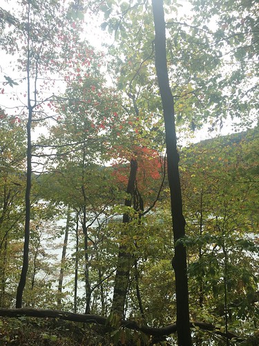
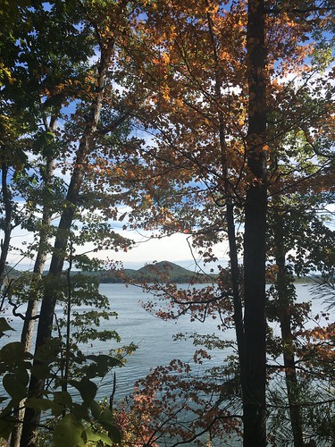
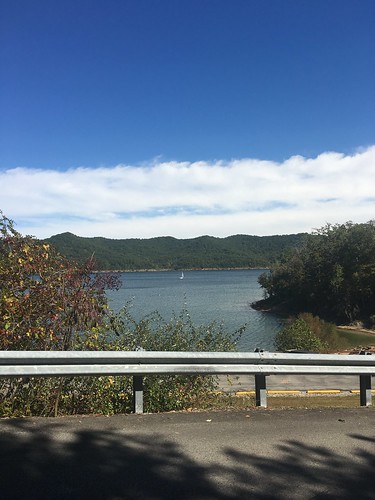
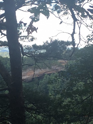
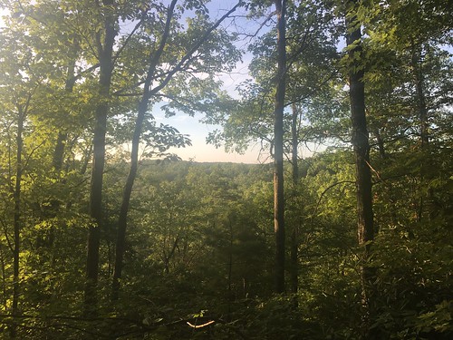
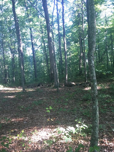
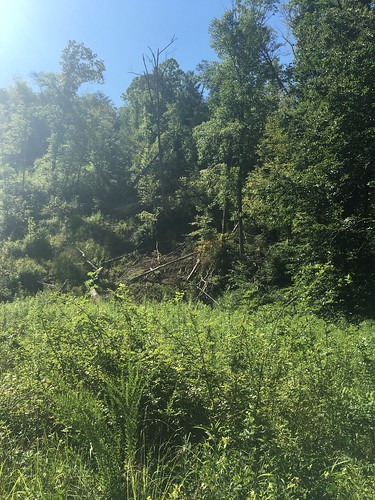
Much of the trail on Saturday went around the Cave Run Lake, and we got a glimpse of fall.
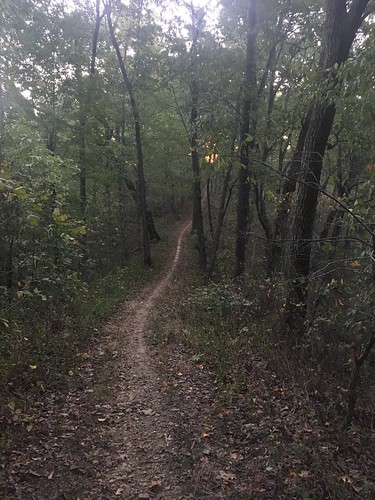
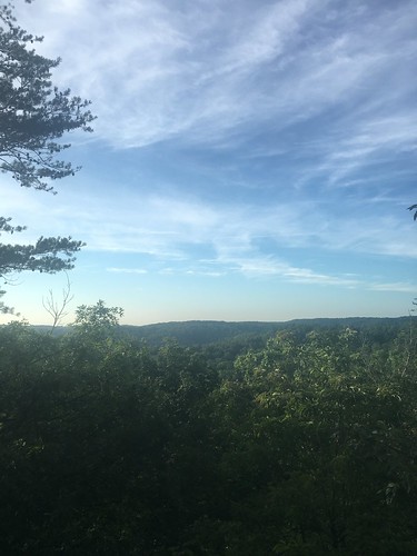
I always enjoy the first bit of hiking on Sunday – I’m often on my own (the last few months, the earliest risers tend to be a few minutes ahead of me, while those who like to sleep in are just waking up as I hit the trail), so I enjoy the solitude and the feeling of the woods waking up around me as I set off for the final miles of the day.
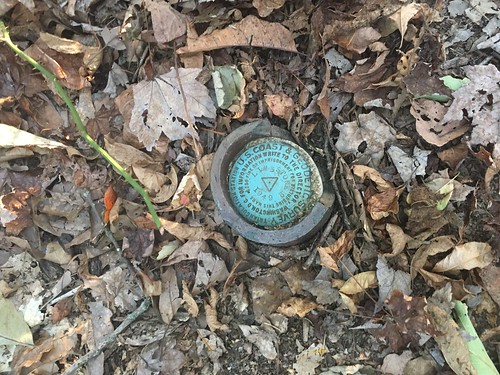
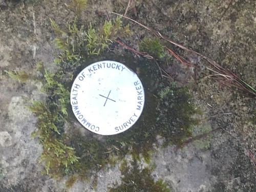
On Sunday, I climbed to the top of Limestone Knob, the highest point in Rowan County with a couple other hikers. No good lookout, but there was a neat survey marker on top. I also tried to figure out the Amburgy Rock lookout, and gave up after a few minutes of trying to find the best way up.
The last few miles on Sunday were road-walking back into Morehead. I have a very strong affinity for Morehead – it always feels like something is going on there, and I love how it’s tucked in to the foothills. With our arrival in Morehead, we now have less than 25 miles to go with our final hike next month.
Finally, a huge thank you to Elizabeth, Class of 2015, who helped with Team One support this weekend while STA director Steve was at a trail conference. She did an awesome job bringing us water along the trail and checking us all in.
Saturday track:
Sunday track:
I’m super excited that I am going to be a guest on WMKV (89.3 FM in Cincinnati, and 89.9 FM in Warren/Butler counties), a local Cincinnati community radio station, this Friday, September 23 from 1-1:30pm Eastern. Good news out of town friends — you can stream WMKV through the website. Scroll down on the homepage or this link will hopefully work.
I will be interviewed by Carol Mundy, who is an amazing local naturalist (and full disclosure, my bff’s mom). We’re going to talk about hiking, getting outdoors, and about my section hike of the Sheltowee Trace. But I’ve also been told that Carol’s hosting style can be full of surprises, so you’ll just have to tune in to listen!
Dates: September 10-11, 2016
Weather: Hot and clear. Rain storm on Saturday night.
Section: Highway 715, near the Red River Gorge suspension bridge to Clear Creek trail head
Miles: Saturday – 16.88 — Gaia GPS, official STA map — 16 miles (Readers note that the track has a weird dog leg at the beginning — I think the satellite didn’t lock on to the correct position when I began recording, but it didn’t appear to affect the mileage);
Sunday – 13.3 miles — Gaia GPS, official STA map — 12.25 miles. (Readers note that my GaiaGPS mileage on Sunday was slightly higher than it should have been due to getting briefly lost.) Scroll to bottom to download GPX tracks for your GPS device or app. The miles displayed in the wordpress plugin are different than what the Gaia app says, which is what I list in this top section. You can also visit my Sheltowee Trace folder on GaiaGPS.
I can’t believe we’re almost done – just two months left. We still had some hot weather this month, but not as bad as August. I’m ready for fall weather to get back, though!
Our hike on Saturday started in the midst of a trail running race – luckily we started around Mile 8, and only shared a few miles of the trail with the racers. Still, it can be really disconcerting to have a runner sneak up on you very fast when you don’t have many places to step off the trail. Luckily I only had a couple dozen pass me before the race turned off of our main trail (and apparently, one of the first runners accidentally missed that turn — bummer for him!) I find competitive trail running to be quite a thing to behold – how do people not trip and die?? I’m sure it helps not to be carrying a 25 pound pack, but how do you ensure you don’t roll an ankle when running over some loose gravel? I just can’t imagine traversing trails without my trekking poles, since they save me from at least one serious injury every time I go out on a hike (I am a klutz, so this is not an exaggeration!) Honestly, rock climbing seems far more safe than trail running.
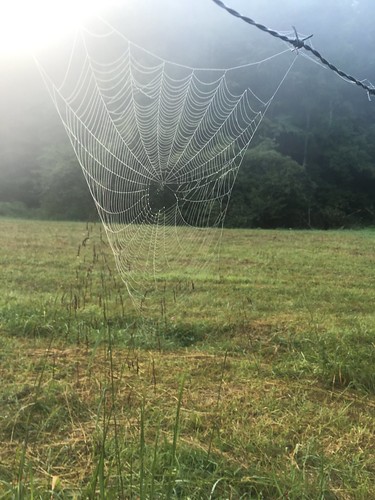
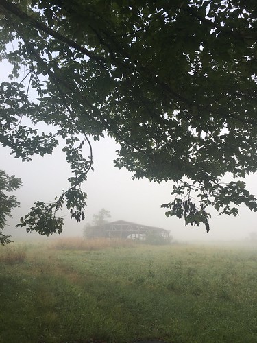
I didn’t take as many pictures on this hike, but I really like the ones I took. There were some great scenes on this hike, especially the spooky-beautiful mist on Sunday morning.
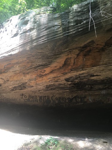
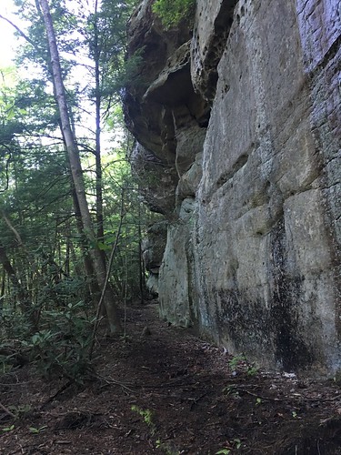
I utterly loathe graffiti on the beautiful rock houses/faces around the trail, but if it’s going to exist, at least it should be entertaining. What’s up with “To Hell with Communism”…? Do you think it dates from the Cold War, or was someone reacting to the recent re-establishment of diplomatic relations with Cuba, or…???
On Saturday night, it rained for a couple of hours. I know doing this is a no-no, but I had a bit of bourbon left in my flask, so I kicked back in the hammock, snug and dry beneath the tarp, and finished it off (this is a no-no because normally I am 100000% religious about not having anything food/drink/smelly related in my hammock because of bear safety reasons. But I figured a bear was not going to be venturing out in the storm). At first I thought, I should read this downloaded ebook of Alexis de Tocqueville (nerd alert…) or journal a bit. And then I thought, this is relaxing AF, I should just rock back and forth and enjoy this for-real version of a white noise machine.
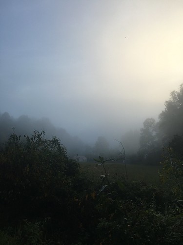
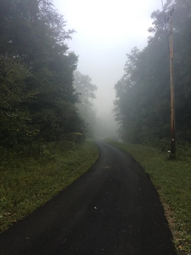
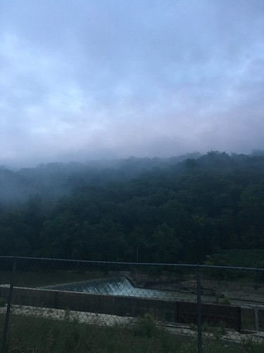
Even though the first few miles of Sunday morning was road-hiking, I loved the views because of the mist. I’m not sure if it’s usually like this, or because of the rain the previous night.
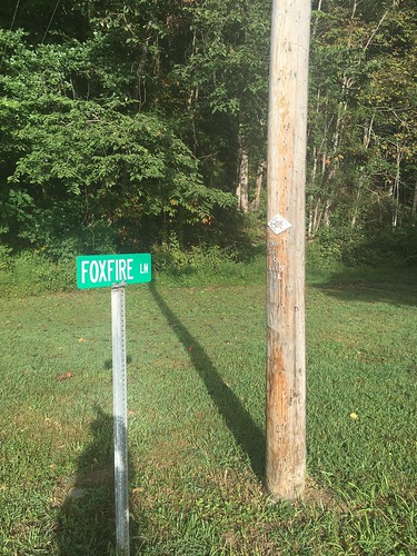
I loved seeing this sign for “Foxfire Lane”…! I am a big fan of the Foxfire books (though I know those originate from Georgia), and it’s cool to see other additional references to foxfire around Appalachia.
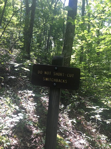
This was one of my favorite things I’ve seen yet along the trail — cutting switchbacks is a huge pet peeve of mine. Just don’t do it! For you non-hikers, switchbacks are when the trail takes long zig-zags back and forth down a hill. The reason you don’t want to shortcut the switchbacks are because it contributes to erosion. Also, don’t you think this is a good metaphor for life?
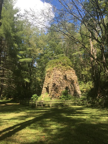
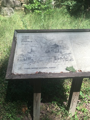
Just before the end of Sunday’s hike, there was a little side-trip option to a picnic area with the cleanest vault toilets I’ve ever encountered. It was definitely worth the extra 5 minutes off the trail to see this crumbling old iron furnace.
Some closing reflections from this hike…. I’ve been doing a lot of work around climate change as part of my current research. This has involved reading a lot about horrifying things happening to parts of the Earth I don’t get to see, like watching sad and heartbreaking documentaries about glaciers melting at alarming speeds near the North Pole. And as I was hiking, I began to think about why it is that folks mourn more easily for glaciers and polar bears than the threatened treasures in our backyards.
For example, the Eastern hemlocks in the region that the Sheltowee Trace goes through are threatened by the wooly adelgid, which scientists tell us will get worse with climate change. I really, REALLY love the hemlocks along the Sheltowee — it’s amazing to me that a tree can have such tiny little needles and yet grow to be so magnificent. And I extra-love hemlocks, because sometimes they have “peg” like structures coming off the trunk (I assume these are branches that fell off, or were chewed off by deer) that are perfect for hanging things off of while in camp.
I often hang my hammock from hemlocks. Regardless of whatever trees I hang from, whenever I take down my hammock I silently thank the trees that supported me through the night (and sometimes touch their bark) and God for letting me be safe another night on the trail. So the idea that hemlocks could possibly disappear from the Sheltowee…? It would be an utter tragedy. I can barely imagine it, and I don’t let myself think about it for very long.
One of the things that is a real bummer about working in the area of climate change is it’s easy to get discouraged and think “Ugh, we’re all screwed. Humans are the worst, and we’re causing everything that is beautiful and lovely in the world to die in horrible numbers.” And while on the one hand that’s true whether we want to believe it or not, I also don’t think it’s a helpful way to move forward through life with a sense of purpose. Wallowing too much in how badly we’ve screwed up can be paralyzing and defeatist. I read an essay earlier today by playwright Tony Kushner titled “Despair is a lie we tell ourselves.” And it’s true — if you succumb to despair, that things are spoiled beyond salvation, you let yourself off the hook for doing your part to appreciate what we still have and fight for it. One of my personal mottos is that famous phrase of the late, great Mother Jones: Pray for the Dead, and Fight Like Hell for the Living. And so when I’m on the trail, I feel blessed and thankful to see a little baby hemlock popping up along the side of the path. The best way yet I’ve figured out to counteract the sense of helplessness I can sometimes feel with my research is to get outside (literally. GET. OUTSIDE. AWAY. FROM. SCREENS.) and bear witness to the fact that life is still very much around us, everywhere.
Thank the Lord.
Saturday track:
Sunday track:
Tonight I went to see Emily St. John Mandel speak at Cincinnati’s Mercantile Library. Mandel is the author of Station Eleven, a novel I have been so wholly obsessed with since reading it last year that I’ve lost count of how many times I’ve recommended it. It’s the only post-apocalyptic novel I’ve ever read that has filled me with awe and hope for our beautiful world, instead of wanting to crawl into bed and hide. The novel imagines a massive pandemic that kills the majority of the world’s population, and follows several characters back and forth through time. One of the main narrative threads involves a Shakespearean troupe (that has a caravan with a quote from Star Trek on the side) that travels around northern Michigan and Canada. In fact, Mandel said that this traveling Shakespeare troupe was the initial seed of the idea for the novel. She noted that when she began writing this part, she originally had the troupe performing a variety of plays and even television shows from the late 20th century, but realized that in a post-apocalyptic world without electricity, the idea of performing “New York real estate situation comedy” (I hope I got the quote right) rang hollow. As she researched both Shakespeare and pandemics, she realized that having a troupe performing exclusively Shakespeare held a particular resonance for the post-pandemic world in Station Eleven; Shakespeare was born during the bubonic plagues that were devastating England, and there was a certain transcendence in the idea of returning to a canon of work that pre-dated electricity in a post-electricity world.
Mandel has wonderfully dry Canadian wit, and talked at length about her research process (my favorite was when she discussed going down Google rabbit holes and reading “unsettling” survivalist message boards – having been down those same rabbit holes myself, “unsettling” is a very charitable way to put it!) as well as why she thinks post-apocalyptic stories are such a frequent part of contemporary culture. Towards the end of her lecture, she ended with a brief anecdote about visiting an exhibit of illuminated manuscripts. Mandel recalled seeing a book over 400 years old, noting that that book comes from a world that has effectively ended, even though human existence has continued – and so the world as we conceive it is continually ending over and over, but we don’t quite realize it because of scale.
There was a brief Q&A at the end, and I attempted to get my fan girl nervous shaky vapors under control (seriously y’all, the only other time I have ever been so overpowered by awe to be in another writer’s presence that I had to take a deep breath and remember to BE COOL was the time I briefly met my archivist writer hero Rand Jimerson) so that I could ask a question about the role of memory in Station Eleven. I managed to snag the last question-asker spot. Here’s a far (FAR!) more eloquent version of what I asked Mandel:
“Hi, I’m an archivist, and I want you to know that a lot of archivists really love your book. Archives often pop up in novels, and when we’ve talked about your book, we’ve talked about the Museum of Civilization, or the historical newspapers that pop up in it. Can you tell us a little bit about how you saw the role of artifacts or written traces of the past in your book’s apocalyptic future?”
She talked a little bit about how the Museum of Civilization came about in the story – she figured that at the end of the world, some folks would probably be stuck in an airport. And while today a 5″ stiletto or an iPad may not seem fascinating, in a world where life changes so dramatically, you could at least show a non-glowing iPad to your child and say “we used to be able to see someone on the other side of the world and talk to them through this.” But then Mandel said something that is very familiar to archivists working in fragile and vulnerable spaces: that after the dust begins to settle from a chaotic and devastating event, people have a “human impulse” to recall the past and to tell their stories.
Archivists who’ve worked around traumatic events know this well – that chaos is often a turning point in human history, but that in the midst of the chaos, preservation of our stories, records, and traces are generally the furthest things from the minds of those who are just trying to hold it together to survive another day. In addition, archivists must be extraordinarily sensitive to how memory can function as a prolonging of trauma. I lived and worked in New Orleans from 2008-2013 (in other words, 3 years after Katrina), and the trauma of the hurricane and federal levee failure was visible on a daily basis. I moved down just in time to evacuate for Hurricane Gustav, the first mandatory evacuation since Katrina. My roommate at the time had survived Katrina as a freshman college student, and her PTSD became fully evident as she got the hell out of town almost a whole day before I managed to evacuate. Towards the end of my time living there, many archivists I knew who had survived Katrina were quite resentful of others who did not experience the same trauma demanding them to tell their stories over, and over, and over to fit a particular narrative of resilience. More recently, my friend and fellow archivist Jarrett Drake, who helped create A People’s Archive of Police Violence in Cleveland, has noted that creating documentation around traumatic events has the very real potential to effect significant harm:
To that end, it matters how we create more archives for black lives, and it’s important that we don’t re-traumatize communities or expose them for more white gaze, exploitation, and plunder.
We archivists have an understandable tendency to panic that if we don’t do something RIGHT! THIS! MINUTE! about archiving contemporary events or dealing with the unceasing volumes of records growing daily, that we may lose everything that matters to the world we live in now, and the world we hope will survive in the future. This was particularly evident to me today, since I spent the whole day in a workshop on managing digital archives. Archivists who care for what we call “born-digital” materials are prone to a weird combination of rampant anxiety and cautious optimism. I would call for another strong measure of something else – humility and grace. We need to recognize that the continuance of culture and memory does not depend on us alone. Even if every professional archivist on the planet disappeared tomorrow (and what a sad and sorry state of affairs this would be), I trust that our fellow human beings would find a way to create archives to continue the memory and the culture we champion as our daily reason for going to work, even if we might not recognize them as archives according to the practices and standards we’ve spent centuries formulating. As Mandel made clear, it is the human impulse to remember. When we archivists are doing our jobs right, we cannot and should not claim that we have the one true answer on what it means to remember. Rather, I hope we add to the multitude of ways in which memory persists through a world that ends over and over again, even as we humans somehow seem to keep muddling through it all.
Dates: August 13-14, 2016
Weather: Hot and clear
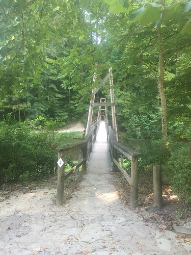
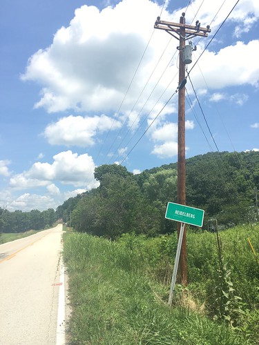
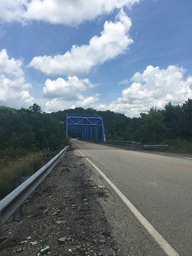
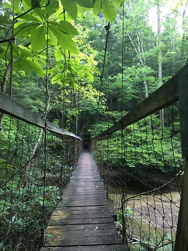
Section: Heidelberg, Kentucky (just across the blue bridge) to Highway 715, near the Red River Gorge suspension bridge
Miles: Saturday – 21.91 — Gaia GPS, official STA map — 20.5 miles (readers note I forgot to activate my app for about 20 minutes during the last leg of Saturday’s hike, so if you look at the track there is a chunk missing);
Sunday – 12.67 miles — Gaia GPS, official STA map — 11.5 miles. Scroll to bottom to download GPX tracks for your GPS device or app. The miles displayed in the wordpress plugin are different than what the Gaia app says, which is what I list in this top section. You can also visit my Sheltowee Trace folder on GaiaGPS.
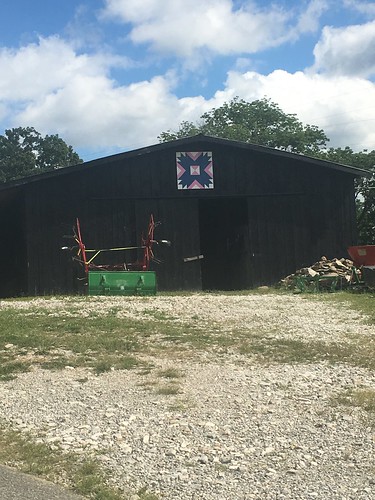
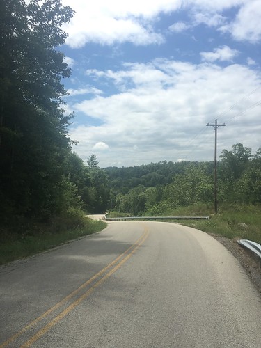
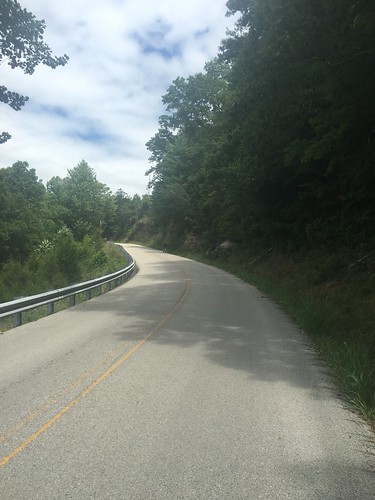
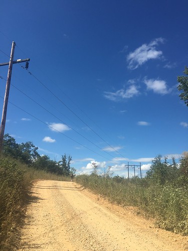
The section of the Sheltowee Trace around Heidelberg has the mildly horror-inducing nickname “the Heidelberg death march” because it consists of so much road-walking. So for Saturday, we were on the road much of the day, including some steep climbs. In the hot and humid August heat.
Luckily I had the foresight to bring my daypack with me, and was able to slack pack on Saturday (my big pack was in STA director Steve’s van, which I carried on Sunday with my daypack squished inside). This helped a lot, but the day was still very challenging. It’s not called a challenge for nothing! Road walking definitely has more cons than pros, but if I can say anything good about it, it’s that you can go on auto-pilot for long stretches. I don’t normally listen to headphones hiking in the woods because it’s too distracting, but as long as you have the volume turned down enough to hear approaching cars, it’s nice to listen to some tunes or podcasts while on a long uphill road climb (my soundtrack on Saturday was a combo of Lizzo’s Good as Hell and some of the tracks from Beyonce’s Lemonade album).
I took a ton of pictures on this hike. I recently finished Roderick Nash’s Wilderness and the American Mind, which is a foundational history on the rhetoric and theory behind the establishment of protected wilderness. I was also in the middle of reading Erik Reece’s Lost Mountain, which recounts a year-long snapshot of mountain top removal and strip mining in Kentucky. So while we were hiking, I was thinking a lot about how humans shape the environment and how even deep inside the woods you can see the work of humans everywhere (trail markers, signs posted on trees, etc). Because this was my frame of mind during the hike, a lot of the pictures show a combination of nature and civilization.
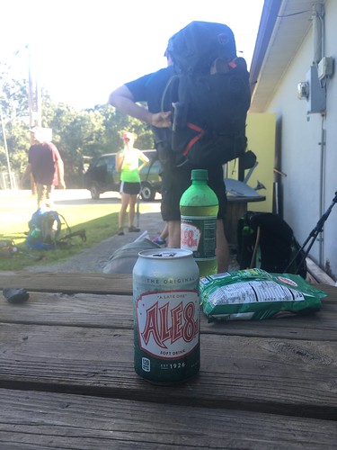
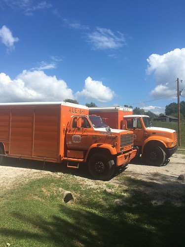
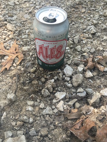
Shortly after we began the “death march” we stopped by this store where we took a break to drink the official beverage of the state of Kentucky, Ale8. Nothing refreshes better during a hot hike!
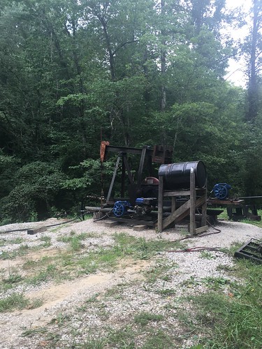
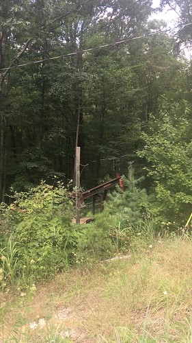
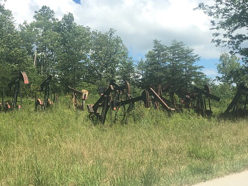
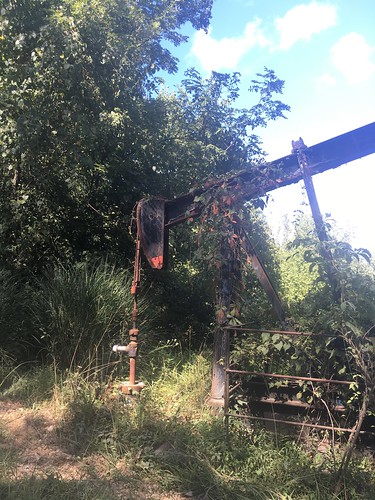
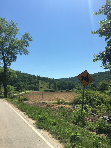
A somewhat surprising thing about this hike was the number of oil wells in the area. We walked by several of them on Saturday’s hike.
This was the most punishing uphill climb. These photos are “behind me” and “in front of me” shots of the climb — according to my app, it was over 350 feet of elevation gain in < 20 minutes. Dear Beyonce, thank you for getting me through this very difficult part!
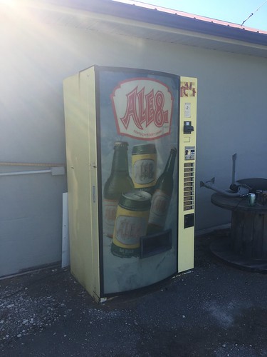
Before we pushed on through the last leg, we stopped to rest our now very tired legs. Too bad these Ale8 trucks weren’t full of frosty beverages to pass out!
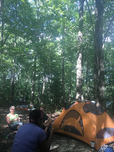
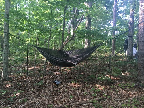
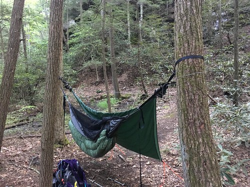
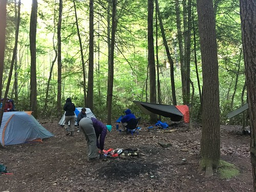
Despite the long road walk, we got to camp with a few hours of daylight left. Folks set up their tents (or hammocks — and this month, I believe the hammock campers may have outnumbered the tent campers by close to 2 to 1) and then congregated near this spot to hang out. We haven’t had a fire for a couple months now — it’s just too darn hot.
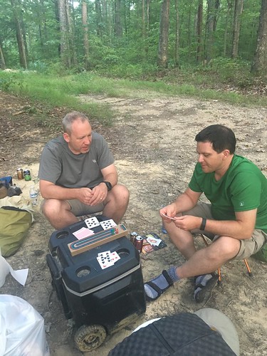
Last month I found out fellow hiker Kurt is a cribbage player. So I brought my board and we played a few games between Friday and Saturday night. We also roped his coworker Greg into playing three-person cribbage, a first for me.
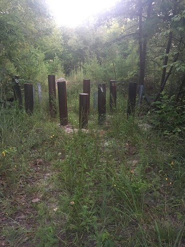
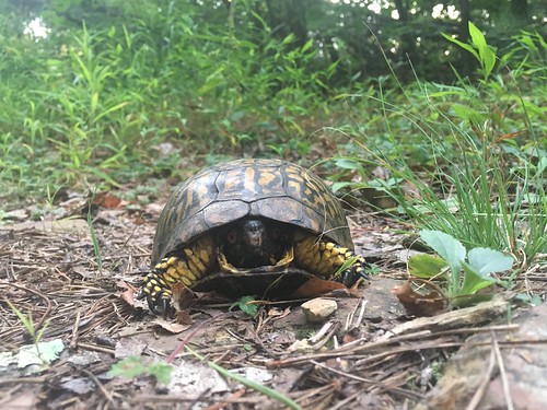
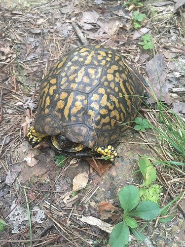
Sunday morning we were back in the woods, though the first part was pretty brushy. As we approached the Red River Gorge area, we encountered more signs of land management, such as these barriers to offroad vehicles. The sunrise was gorgeous, and I even encountered a living symbol of the trail, this semi-freaked out box turtle!
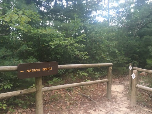
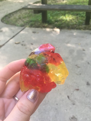
It was a hot and humid morning, and when I stopped at the Hemlock Lodge in Natural Bridge State Park to unpack some snacks, my gummy bears turned into this…
The last few miles felt really long – luckily I knocked them out just before some rainstorms rolled in. And I saw more critters towards the end of the Sunday hike – a black snake slithered across the path, and an injured frog (toad?) was doing loopy circles on the way (thankfully fellow hiker Keely nudged it out of the way!). Unfortunately no pictures of either.
It’s really hard to believe we only have 3 months left to go. We’re now officially down to less than 100 miles to go!
Saturday track:
Sunday track:
Dates: July 16-17, 2016
Weather: Very hot and clear
Section: Elisha Branch Road at US-421 (near McKee, Kentucky) to Heidelberg, Kentucky (just across the blue bridge)
Miles: Saturday – 18.73 miles — Gaia GPS, official STA map — just under 17 miles;
Sunday – 12.92 miles — Gaia GPS, official STA map — just under 12 miles. Scroll to bottom to download GPX tracks for your GPS device or app. The miles displayed in the wordpress plugin are different than what the Gaia app says, which is what I list in this top section. You can also visit my Sheltowee Trace folder on GaiaGPS.
This was a really straightforward hike — and since I’m trying to hurry up and get this posted before packing up for a conference, it’s going to be a pretty brief post!
I first got interested in the Sheltowee after my friend Claire hiked it last year. When I hung out with her last winter to grill her all about the hike, she told me at some point heading out to the monthly hike becomes semi-routine and not quite as big of a deal as it is during the first few months. I’ve found this to be the case by July — it’s kind of nice in a way. I don’t get worked up about my gear selection the way I did back in the first few months, I just get it together and don’t overthink it.
Saturday highlights:
The trail was pretty well-blazed and easy to navigate. The trail still had plenty of mudholes, but nowhere as bad as Section 6. Not too many tree blow downs. On the whole, it was pretty easy, but the heat was bad enough I had to stop several times in order to rest.
We got into camp with several hours to go until sunset, and while hanging around, I found tons of ticks crawling around. Yuck. Luckily managed to brush most of them off. My appetite still disappears almost entirely in the heat.
Sunday highlights:
Some rowdy dogs started following and yapping at me shortly after leaving camp. Luckily Steve had warned us, and I had my poles ready in case of trouble. I dropped my voice into the lowest possible register and yelled GO HOME!!! and luckily got through the stretch without issue.
Sunday’s section wasn’t as well-blazed, and the trail got a little hard to find in some spots.
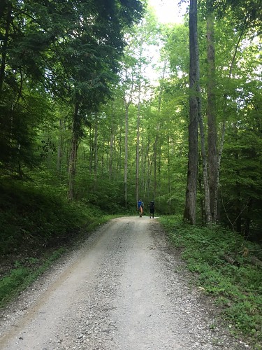
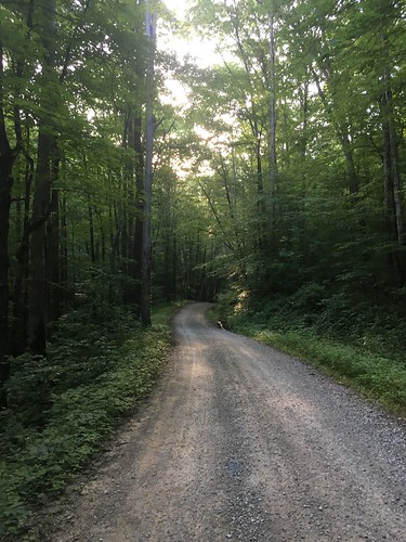
Luckily I never lost it entirely, and soon enough it was on to the long, hot, and brutal road walk. At least with road walking you can sort of go on auto-pilot, and it was a pretty quiet stretch of road until you hit the left turn on KY 399 to Heidelberg. I’ve previewed the map for August’s section — a lot of roadwalking on a somewhat busy stretch. Let’s hope we hit the road early enough to get the worst over with early!
I got back to the car, and found several more ticks had crawled underneath my socks. Picked them off, and hit the road back to Cincinnati. Until next time…
Saturday track:
Sunday track:
Dates: June 11-12, 2016
Weather: Hot and clear
Section: Camp Wildcat Battlefield parking lot to Elisha Branch Road at US-421 (near McKee, Kentucky)
Miles: Saturday – 20.06 miles — Gaia GPS, official STA map — 20 miles;
Sunday – 12.1 miles — Gaia GPS, official STA map — 12 miles. Scroll to bottom to download GPX tracks for your GPS device or app. The miles displayed in the wordpress plugin are different than what the Gaia app says, which is what I list in this top section. You can also visit my Sheltowee Trace folder on GaiaGPS.
First things first — our fearless Sheltowee Trace Association director, Steve, recently told us that one of his mapping experts will be doing a presentation at the STA October conference on the mismatch between official map miles, and folks’ GPS devices. In many cases, this probably has to do with elevation issues and possibly walking zig-zag style around the trail. In the case of wearable devices (like a FitBit or GPS watch), the device measurement may not accurately take into account one’s stride.
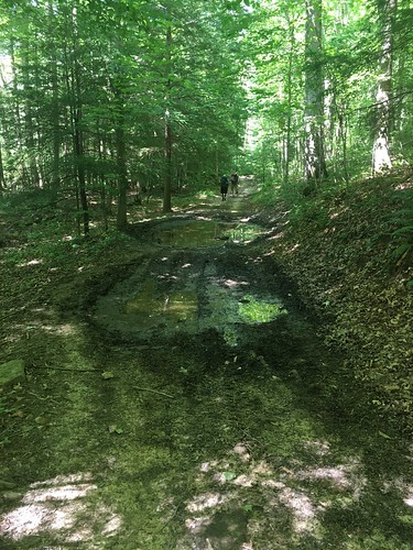
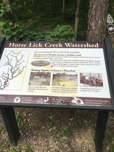
Section 6 was our first major taste of road-walking — as well as some brutally hot temperatures. I never managed to look at the temperature that day (out of cell service areas most of the weekend), but I think the forecast was in the mid-90s, and it sure felt like it. Much of the trail on this month was shared with dirt bikes, ATVs, and horses, which meant that the trail was very, very muddy and full of standing water in many parts. On the bright side, it meant that the trail never “disappeared” (except for a couple of confusing turns and one creek crossing which required studious map consultation).
Overall, despite the mud, road-walking and some of the noise, I really enjoyed this section. I think it was partly due to the monthly hike being “routine” at this point, a growing camaraderie with the other hikers, all the trees being fully leafed, and a lighter pack load due to the warmer weather and going stoveless. More about that further down!
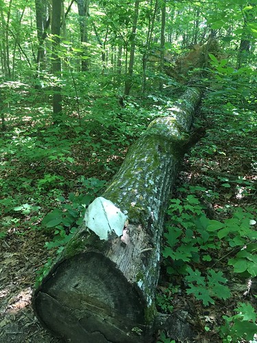
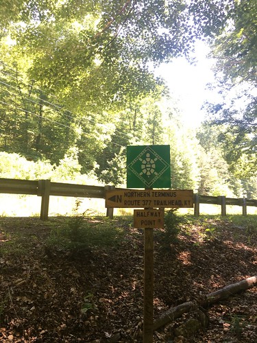
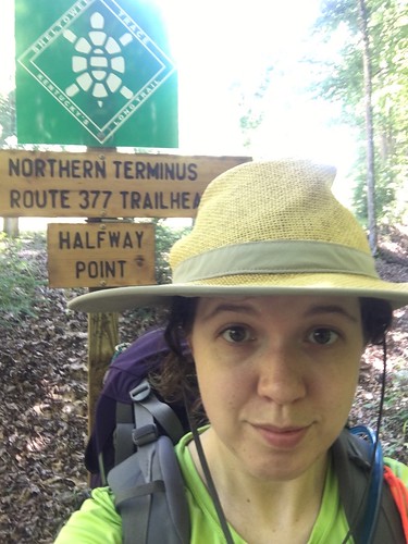
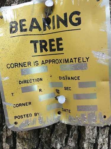
On Saturday morning, we hit a really important milestone — the halfway point marker of the Sheltowee Trace! I think this is around Mile 162 according the official maps, so I would have thought it would be located a couple miles away (the current trail mileage is 319 miles). Anyone have some insights? Either way, it was a really fun place to stop and take some pictures before we hit a 7 mile stretch of hot and humid road-walking.
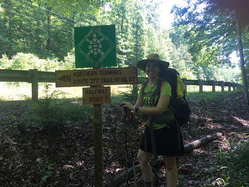
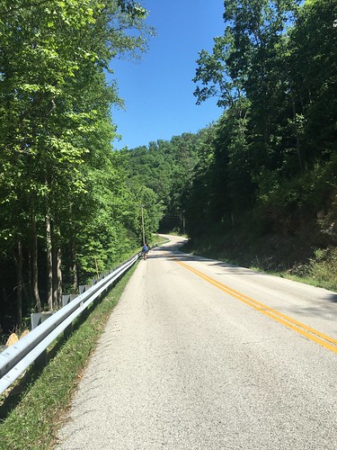
You’ll notice in that photo I have trail runnners on — there were several things I mixed up on this section. First, I bought trail runners a while ago, and had only day-hiked in them until recently. Since I knew it would be hot and there was a lot of road walking (which always feels awful in boots), I ditched my beloved Vasque boots for this weekend and switched to my Brooks trail runners. I’m a convert, at least for warm months. I’ll be back in the boots once we get back into bad weather.
Second, I recently bought this amazing hiking skirt from a woman who started her own business called Purple Rain Adventure Skirts. It was awesome! I was hesitant to wear it on earlier sections of the trail that required a lot of climbing over logs (read: situations when you really want to wear pants). Luckily there were almost no downed trees blocking the trail on this section. I wear dresses every day to work, so believe it or not I feel more normal in a skirt or a dress than pants. The best thing about this skirt besides the breathable material were the generous pockets, and the fact it never twisted around. I don’t know what kind of sewing magic she did to make that possible, but women’s skirts almost always twist around when you walk long enough in them, and it’s a miracle that this one didn’t. It also kept me from getting overheated on the long day.
Finally, I ditched the stove this time! I was going to re-hydrate some couscous in a bag, but I kind of lost my appetite on Saturday and had to force myself to eat a little bit of food. The only thing I was really worried about missing out on was coffee, but I found that the Starbucks Via Instant Iced Coffee packets were just fine. Like trail runners, I am a total convert to stoveless eating for at least the warmer months. Even though I use a very lightweight alcohol stove, the weight savings were noticeable without the bowls and fuel.
So these changes all started with a ‘S’ — shoes, skirt, and stove(less). I think these are now my ‘S’ummer ‘S’avings (weight-wise). I also ditched my underquilt this month and was mostly OK without it. I usually weigh my pack once I pack everything (before and after adding in my Platypus filled with water), and in June I saved about 2.6 pounds of base weight over previous months.
Doesn’t sound like a lot, but when you’re slogging through that road walk shown above, it makes every bit of difference. I definitely felt like it was a physically easier hike than in past months, although at one point on that road I got a bit woozy (mostly due to the sun and not eating enough snacks — I was okay after a brief rest).
Shagbark hickories are one of my favorite trees. This one was beautiful! Fun fact: 50 West Brewing in Cincinnati has made a beer with shagbark.
Sometimes when a turn isn’t obvious, an enterprising hiker in the front will thoughtfully lay down some stick arrows.
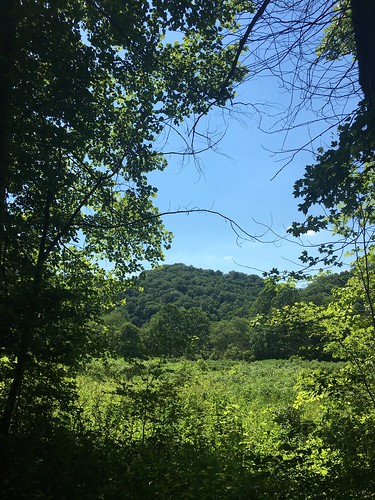
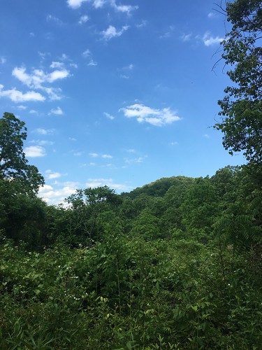
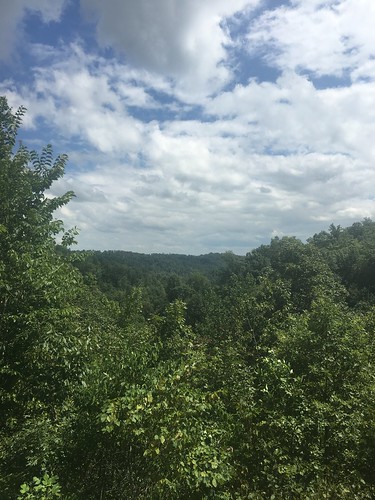
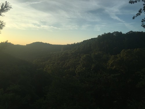
Aren’t these hills gorgeous?
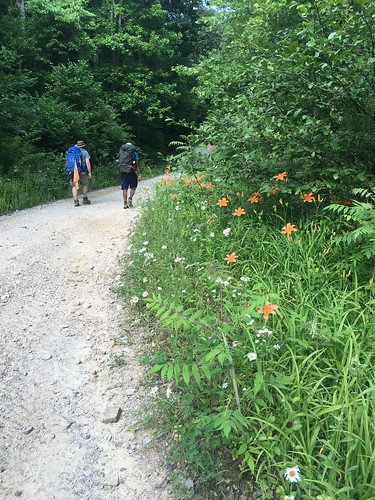
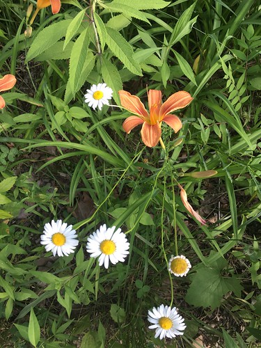
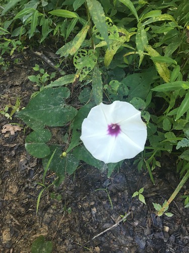
Not only were there gorgeous hills, and shady trees, but some very nice wildflowers.
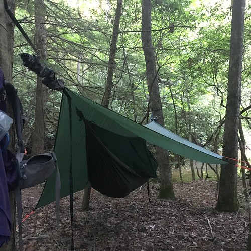
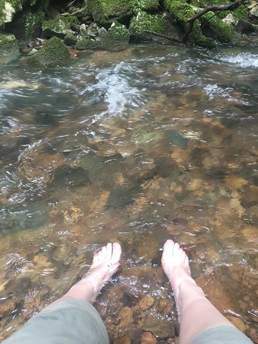
Hard to see, but just past the trees behind my hammock was a tiny little fall. A great place to hang out and get some fresh water.
The infamous uphill climb out of camp the next day (it really wasn’t *that* bad).
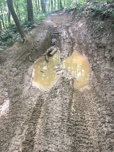
This mud hole sort of looks like a giant deer hoof print, huh?
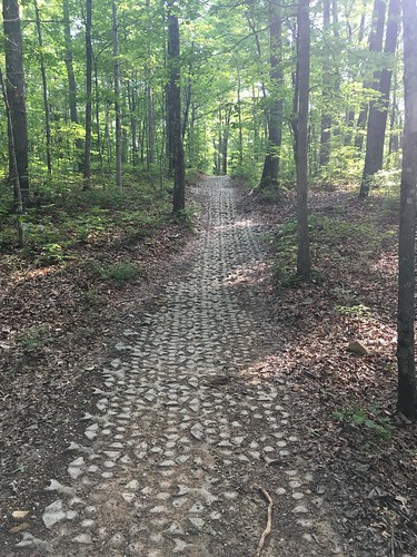
Some parts of the trail near roads have pavers (not sure if that is the right term), presumably to prevent further soil erosion due to vehicle use.
After this we had another mile or so of road-walking — this was the last good photo opportunity!
Saturday track:
Sunday track:
Dates: May 14-15, 2016
Weather: Almost perfect weather both days! A little bit of periodic drizzle on Saturday.
Section: Highway 192 trailhead lot to Camp Wildcat Battlefield parking lot
Miles: Saturday – 23.06 miles, Sunday – 10.19 miles [Saturday disclaimer: I got a bit lost just after crossing the suspension bridge at Mile 186 (Sinking Creek), and had to backtrack, which added on just over a mile] (scroll to bottom to download GPX tracks for your GPS device or app. The miles displayed in the wordpress plugin are different than what the Gaia app says, which is what I list in this top section. You can also visit my Sheltowee Trace folder on GaiaGPS. Hikers be aware that miles tracked in GPS are usually longer than the miles noted on the official Sheltowee Trace maps.)
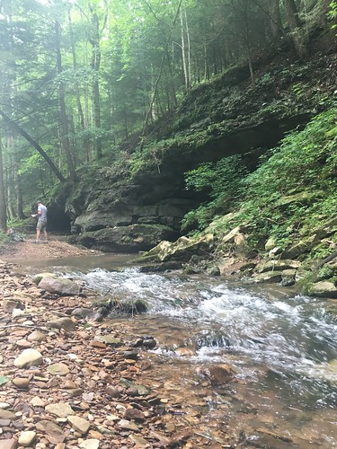
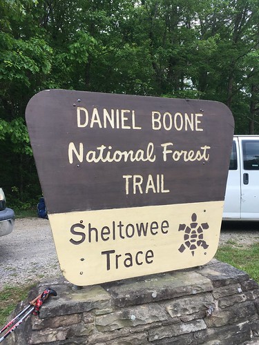
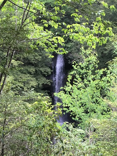
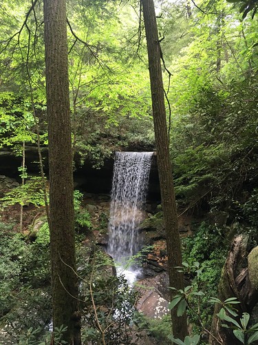
Another beautiful section of the Sheltowee! This section also included more road walking than any other section to date. At least we got some beautiful waterfalls at the beginning.
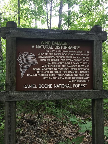
Shortly before we hit this section of (by now, not super obvious) wind-damaged forest, there had been a very confusing fork with no visible blazes. I had been standing around for quite some time trying to figure out what to do next when another hiker (who has been on the ST many times, and carries around some spare blazes) popped back up to let me know the correct way to go. He added a blaze shortly before this section to help prevent further confusion for hikers behind us.
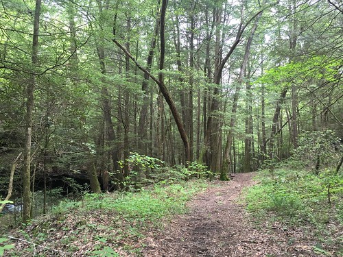
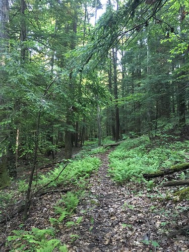
One of my favorite things about being a year-round hiker is you really appreciate how beautiful the forest gets after everything being leafless and gray for months.
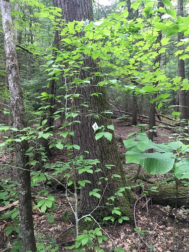
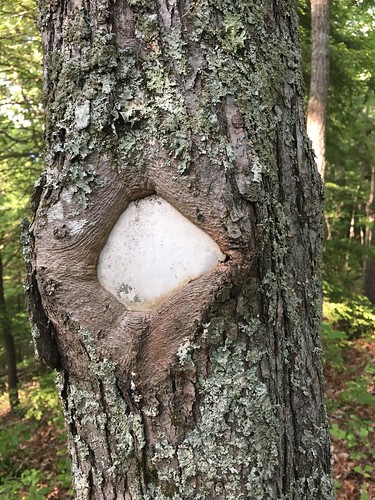
Like other recent sections, this one required keeping the map handy at all times – several places in which the blazing was less than ideal (more so on Saturday; Sunday’s section was well-blazed and easily navigable because of the road hiking at the end) or when the trail went faint meant that I wasn’t always confident of my place. Here you can see where the blaze was somewhat hidden behind some branches. I didn’t see this at first because the trail had grown somewhat faint going around it.
This section had a lot of dirt bikers riding in the vicinity. We could also hear a nearby drag racing course. It sounded like a car would suddenly drive up on to the trail!
Shortly after this suspension bridge at Sinking Creek, I wandered off the trail (and apparently onto private property…) and added a little bit over 1 mile onto my total Saturday mileage. Bummer! And unfortunately it happened because there was not great blazing on the other side of the bridge.
After getting back on the trail, it popped up shortly afterward into an open field.
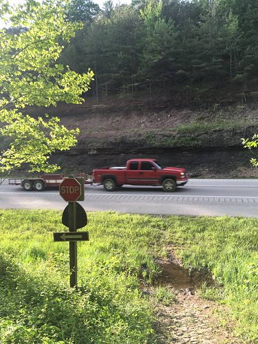
After what felt like a long time I finally reaching Highway 80, and had started to get a bit anxious about hitting camp before the sun set. Highway 80 is a little intimidating to cross, but luckily there weren’t any blind curves so I was able to scurry across quickly.
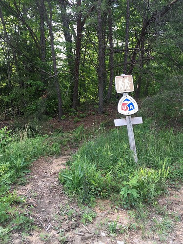
Blazes weren’t always obvious on the trees in this section — the old white diamond blazes had been affixed to the trees many years ago, and the trees had started to grow over and around the blazes.
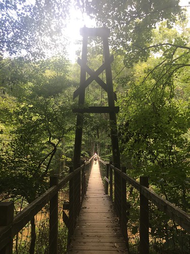
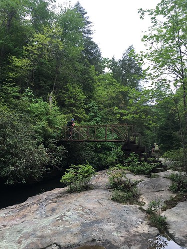
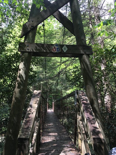
Shortly after, you cross a very quiet county road. By the time the sun was obviously getting lower in the sky, and while I still had about an hour until sunset, because the hills were pretty tall and the sun had set on the other side of the hill I was on, the light was quickly getting dim. A few folks made it into camp well after sunset — very glad I made it just in time to have a few last minutes of light to hang my hammock. Most of the group camped on the other side of the Hawk Creek suspension bridge.
We had a semi-leisurely next morning breaking camp, knowing we only had half the mileage of the day before, and the epic treat of getting to stop by a diner! I didn’t really fall into a deep sleep, but I have been enjoying my new suspension, and always find laying in a hammock to be so comfortable compared to sleeping on the ground – especially because my shoulders and legs are usually pretty sore after 20 miles with a big pack.
The forested part of Sunday’s hike was particularly enjoyable — beautiful weather, clear trail, and a challenging but pretty climb.
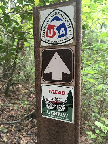
This sign was shortly before we hit a restoration area of the Trace.
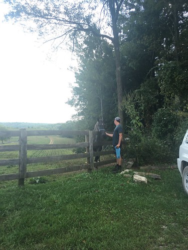
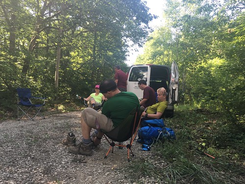
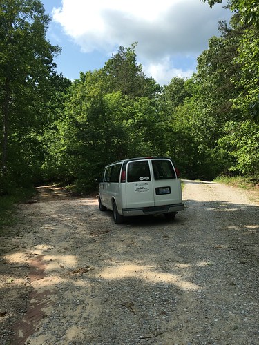
After leaving the restoration area, we were on a gravel road down to the diner next to 75. Whenever you see Steve’s (Sheltowee Trace director) van, you know you’re on the right path.
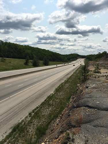
Crossing over 75 was a little anti-climactic, but still kind of exciting since it’s about 15-ish miles from the half-way point of the entire trail.
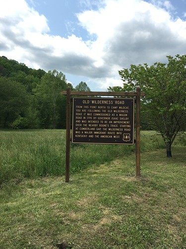
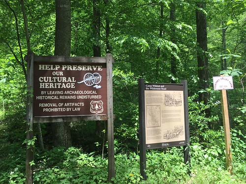
The last stretch was heading up roads (including one last very steep incline) to an old Civil War site, Wildcat Battlefield.
Saturday track:
Sunday track: