Eira Tansey

Posts Tagged ‘Daniel Boone National Forest’

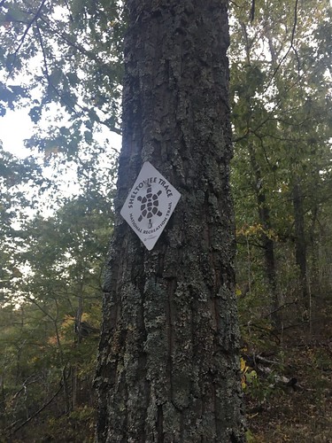
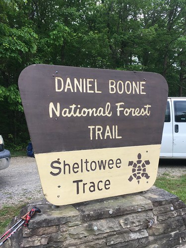
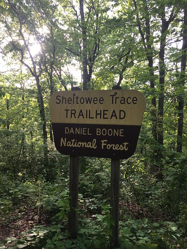
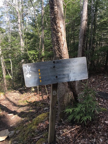
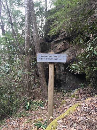
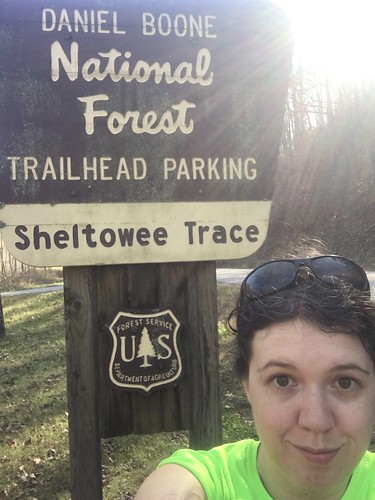
Sheltowee Trace: Section 11 – Morehead to the Northern Terminus

Dates: November 12-13, 2016
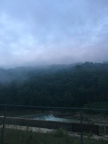
Weather: Cool and a bit chilly during the day, cold overnight.
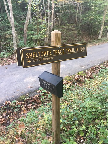
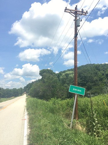
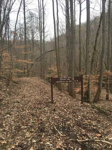
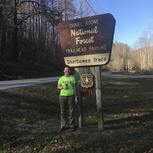
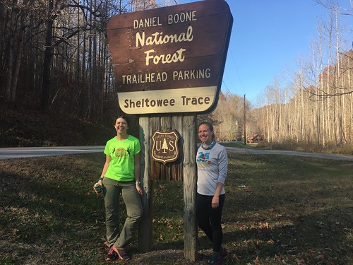
Section: Morehead, Kentucky to the Northern Terminus
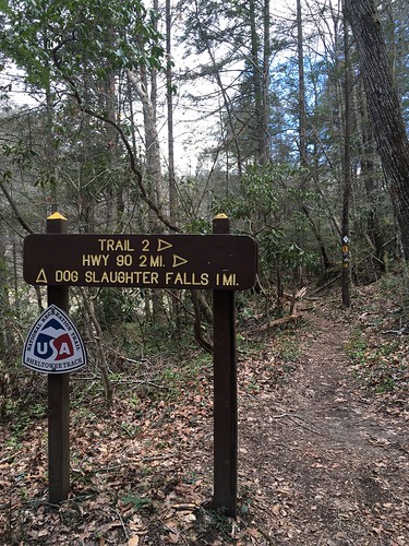
Miles: Saturday – 14.29 — Gaia GPS, official STA map — 13.25 miles;
Sunday – 11.78 — Gaia GPS, official STA map — 11 miles. Scroll to bottom to download GPX tracks for your GPS device or app. The miles displayed in the wordpress plugin are different than what the Gaia app says, which is what I list in this top section. You can also visit my Sheltowee Trace folder on GaiaGPS.

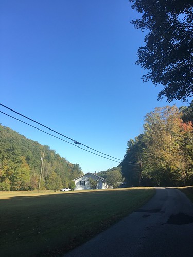
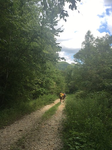
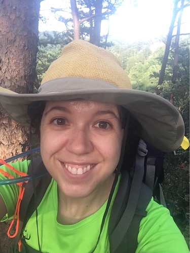
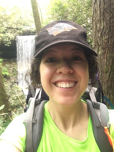
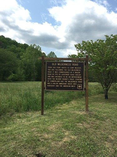
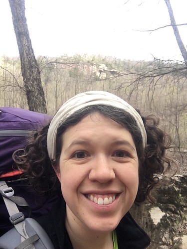
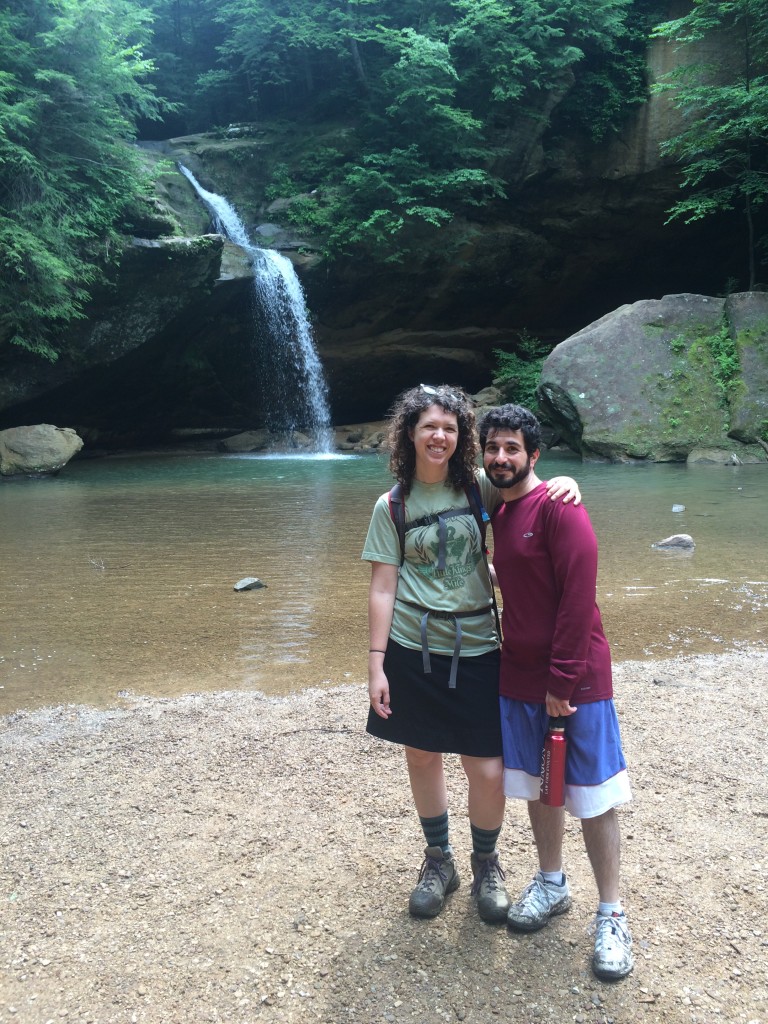
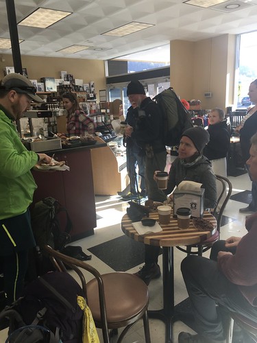
The last month! It was a joy to hike again with my friend Susanna, who recently returned from her Pacific Crest Trail thru-hike and joined me for this last section. We had several treats for our last hike on the Sheltowee. The first was right at the beginning, when we stopped by the Fuzzy Duck Coffee Shop in Morehead. Nothing like starting your hike out with a little extra caffeine!

Fuzzy Duck Coffee Shop, Morehead

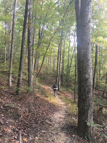
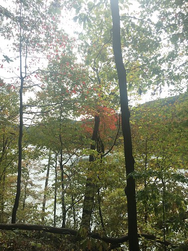
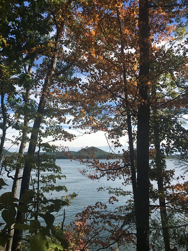
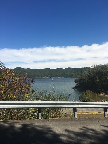
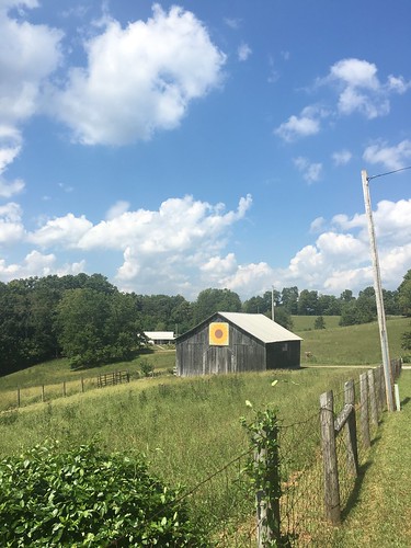
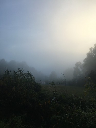
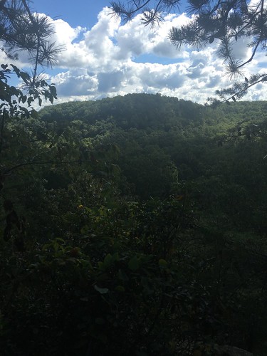
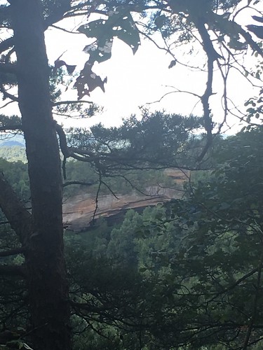
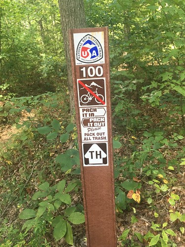
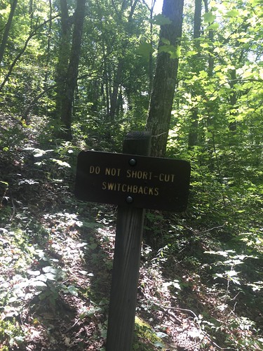
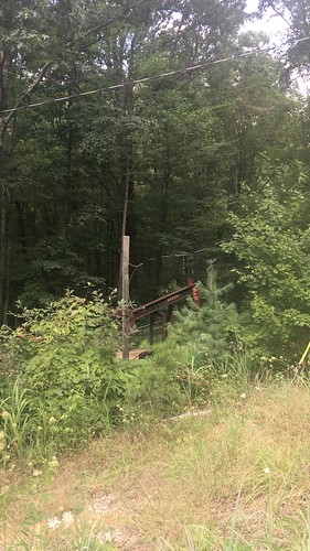
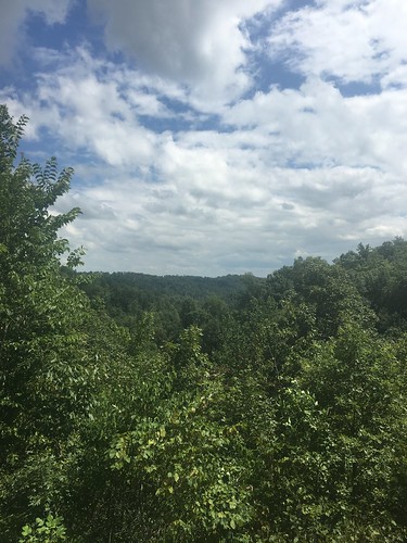
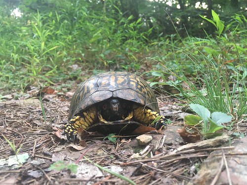
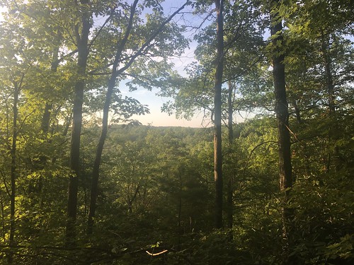
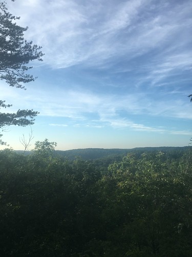
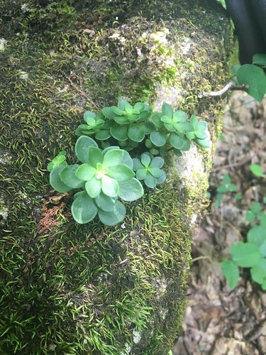
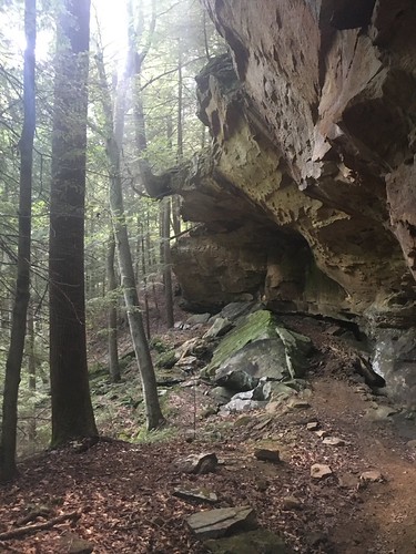
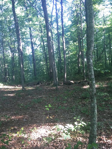
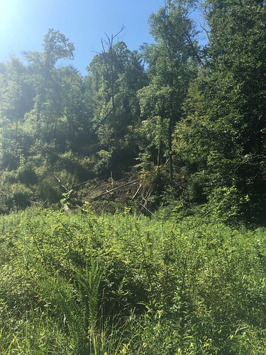
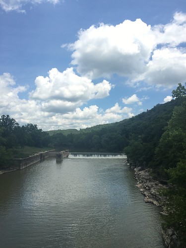
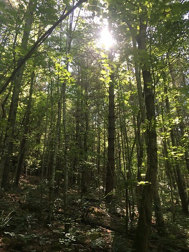
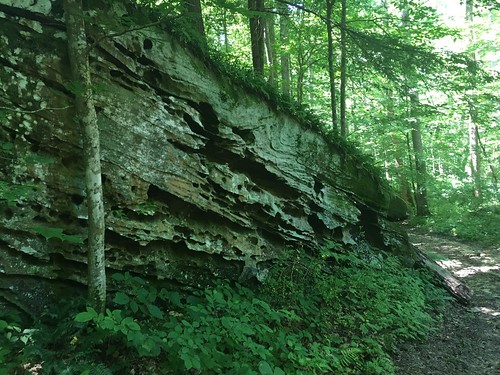
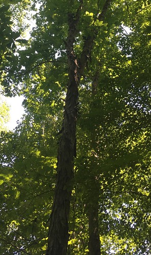
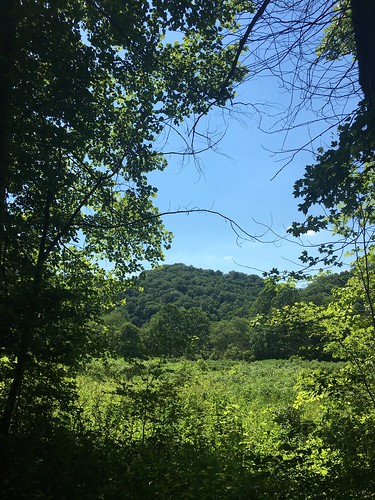
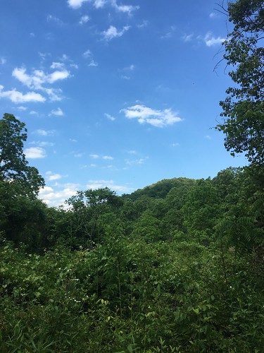
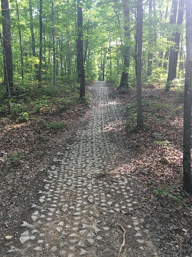
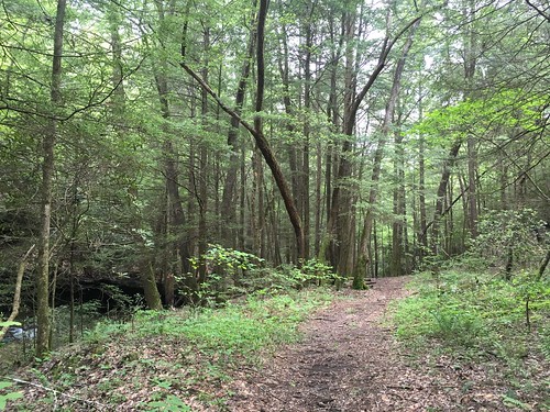
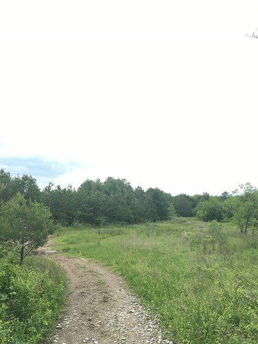
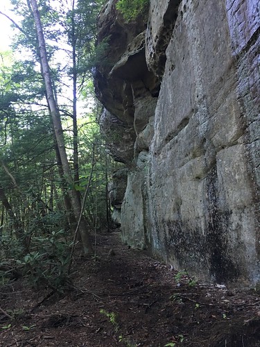
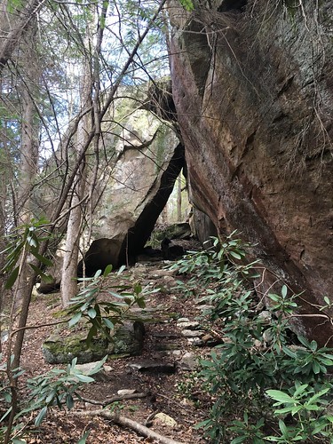
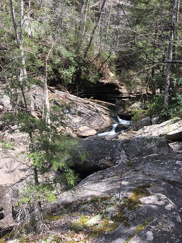
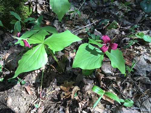
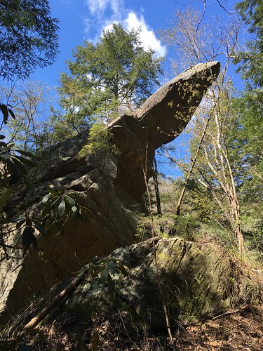
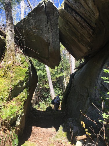
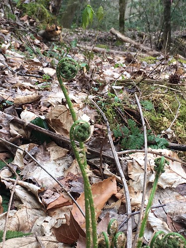
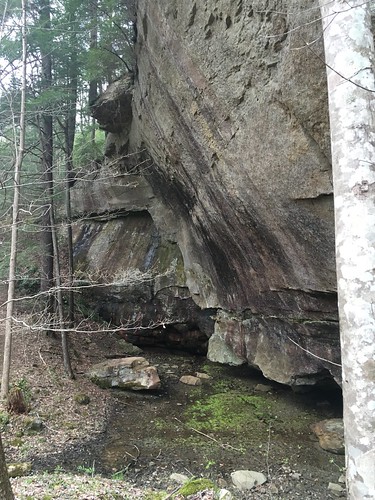
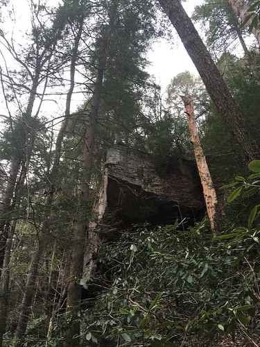
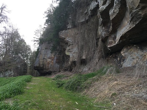
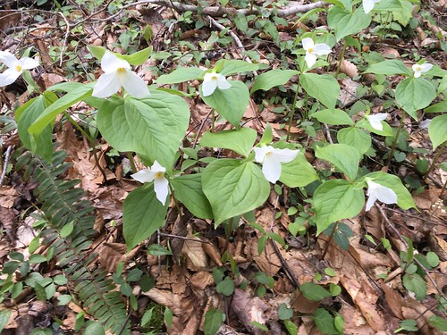
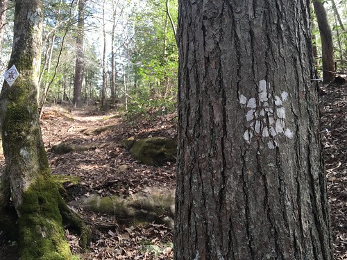
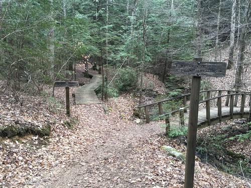
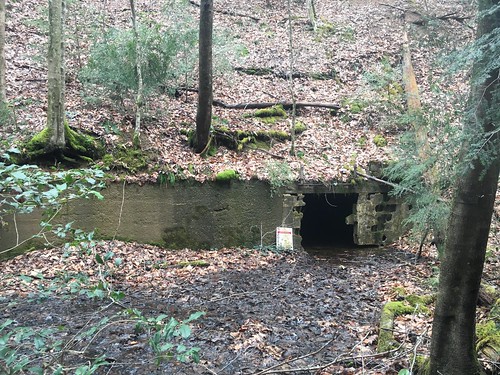
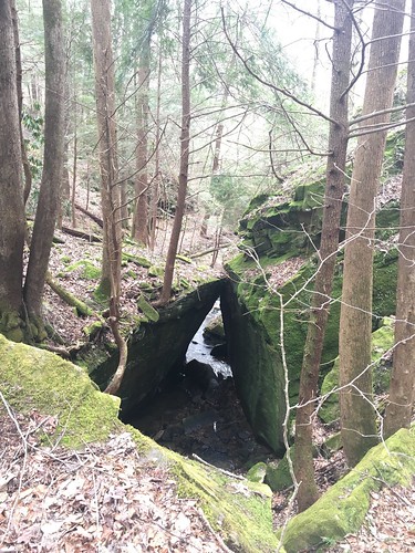
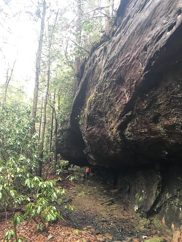
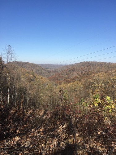
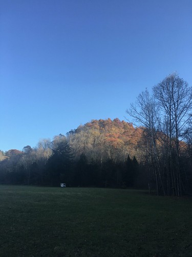
The hike outside of Morehead goes by Morehead State and climbs a steep set of switchbacks up some hills. We had worked up a sweat by the time we got to the top. There was still a bit of fall color lingering in the hills.

Last of fall colors

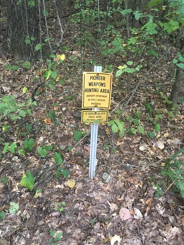
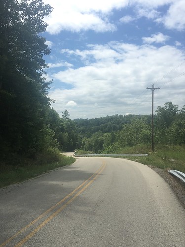
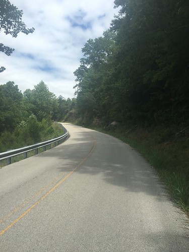
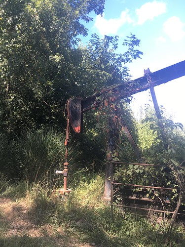
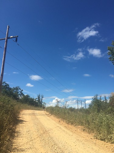
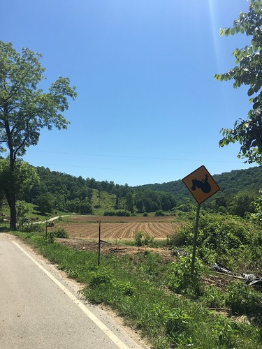
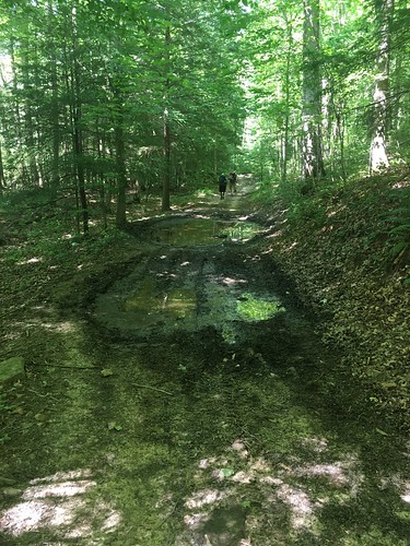
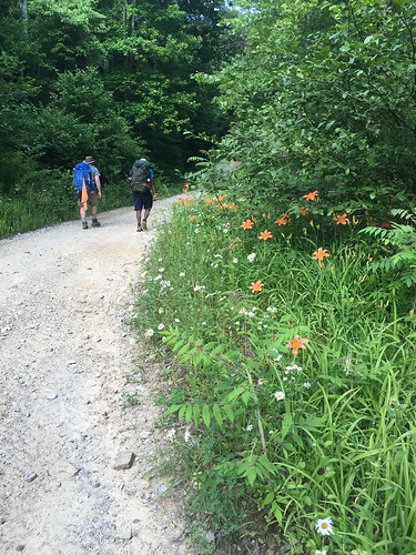
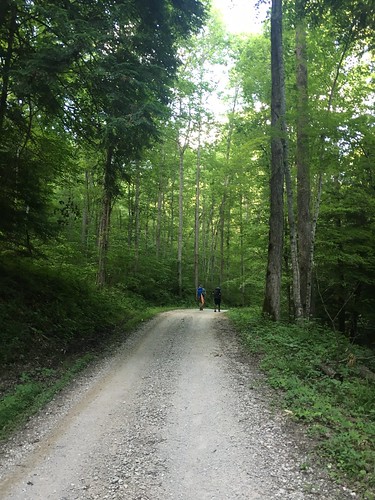
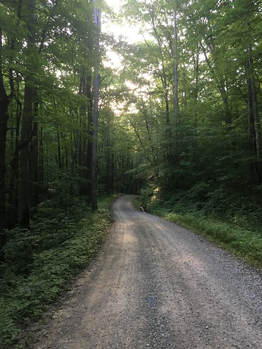
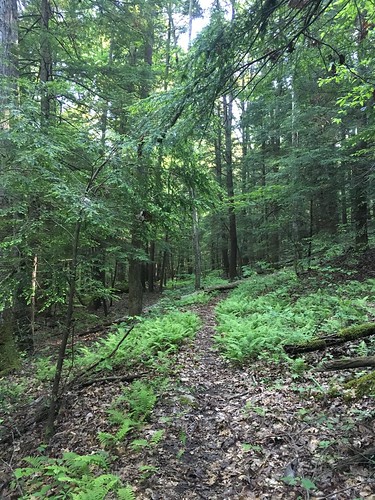
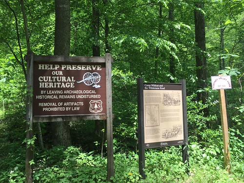
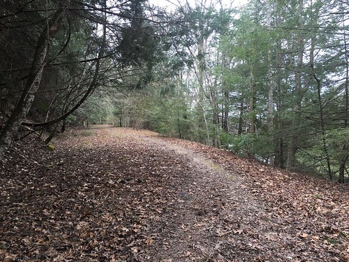
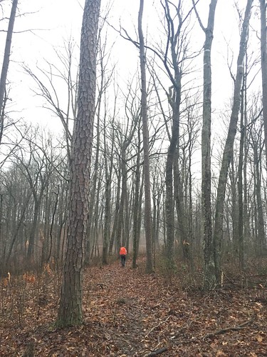
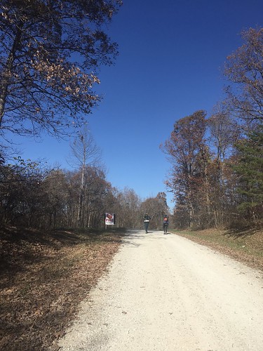
There was a lot of forest service road walking, and because it was the first weekend of rifle deer hunting season, there were lots of hunters out. Always remember to wear orange during fall and winter!

Walking Uphill

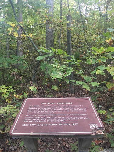
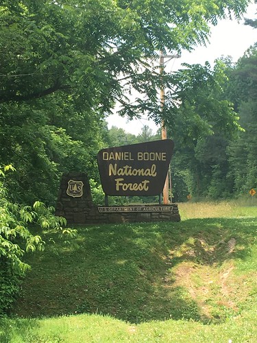
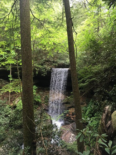
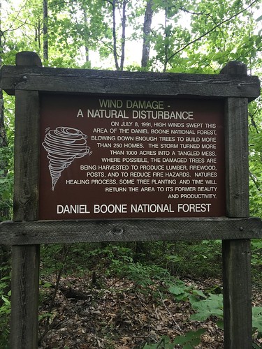
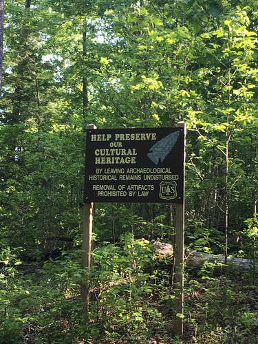
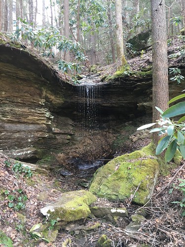
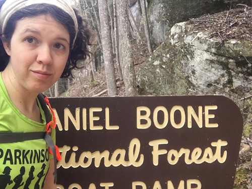
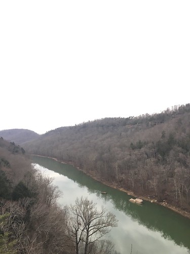
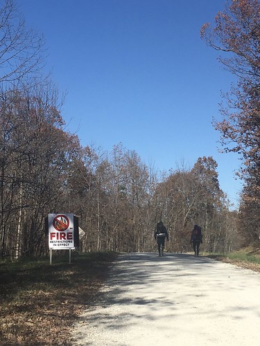
There was also a ban on fire in the area – at the time we were hiking, there had been recent forest fires further south in the Daniel Boone National Forest, around the Red River Gorge area.

Fire Warning

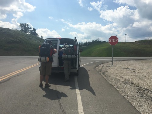
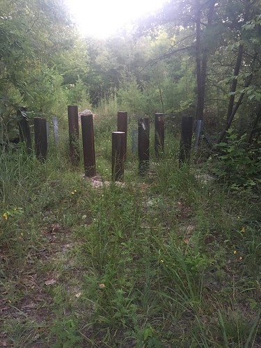
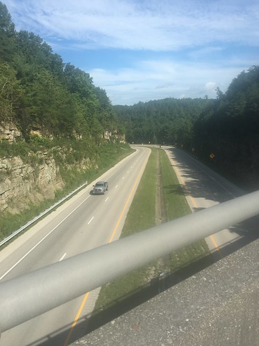
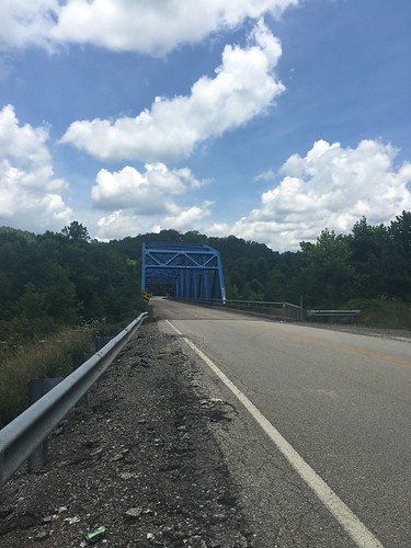
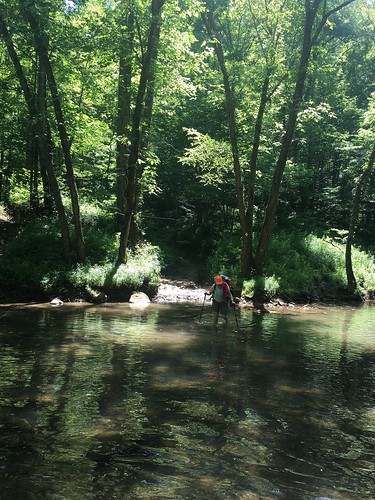
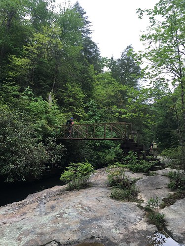
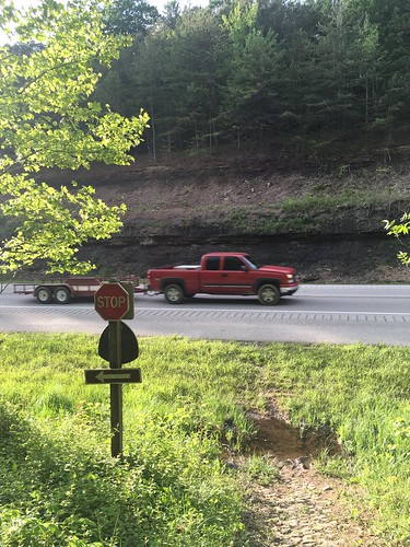
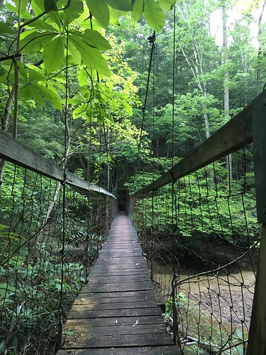
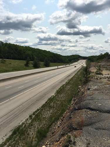
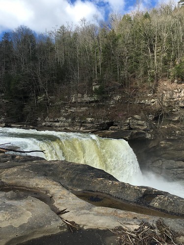
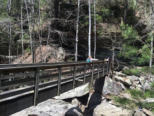
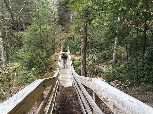
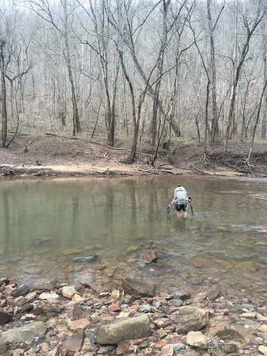
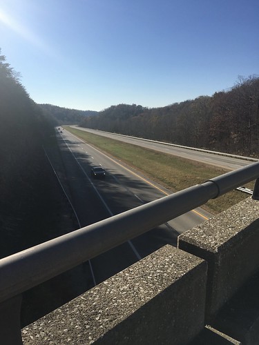
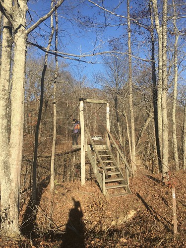
We had one last major crossing – over I-64.

Crossing I-64

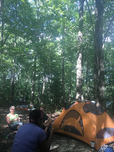
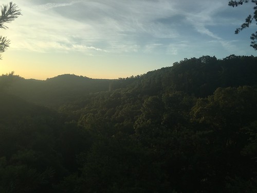
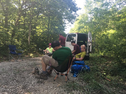
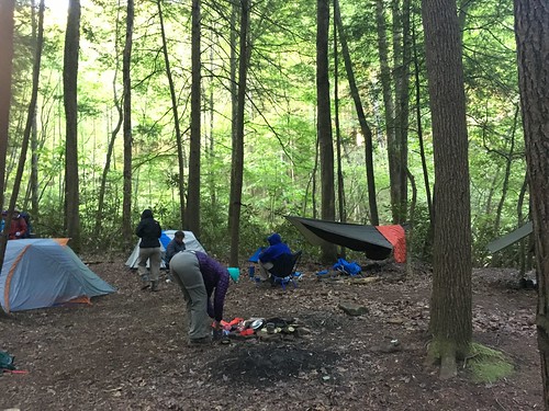
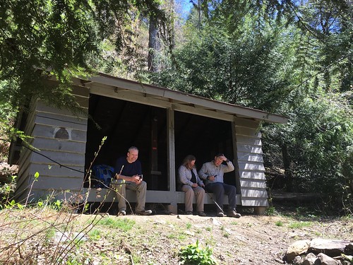
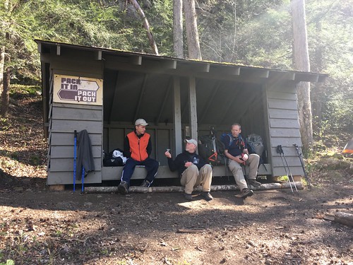
We arrived at camp a couple hours before twilight.

Hillside before twilight

Field Suspension Bridge

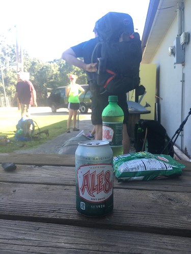
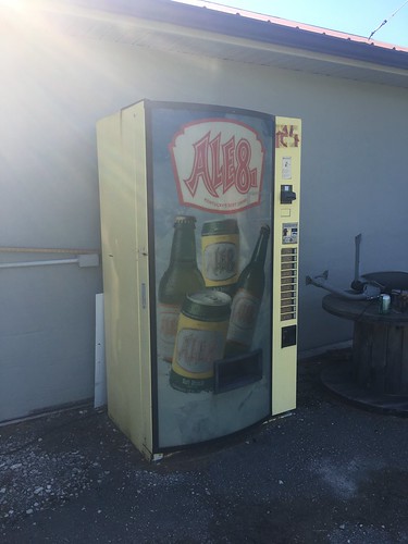
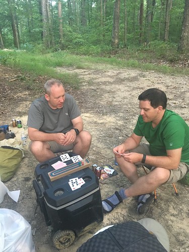
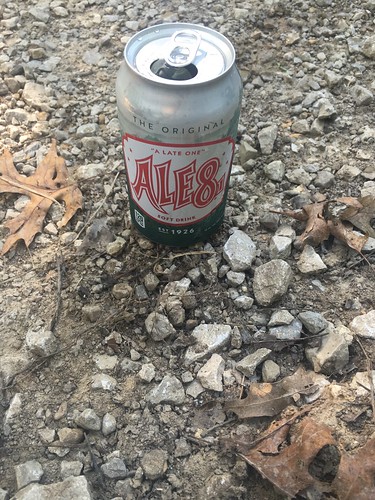
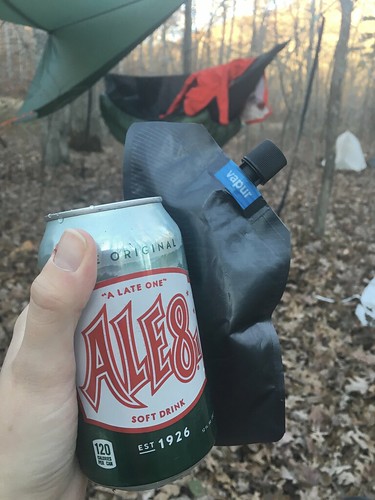
STA director Steve was kind enough to bring us sodas, so I kicked back with my FAVORITE post-hike cocktail: a can of Ale8 and some bourbon. Seriously, there is nothing better after a long day of hiking in Kentucky.

Post-hike cocktail of Ale8 and bourbon

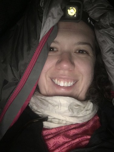
We couldn’t have a campfire due to fire restrictions, but some Trail Angels (aka members of previous Sheltowee Trace End to End classes) brought us chili, warm cornbread, brownies, and hot beverages. Amazing! Most of us went to bed pretty early, since it was so darn cold without a fire.

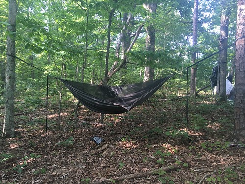
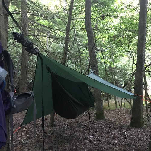
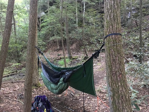
Here’s me hunkered down in my hammock – luckily I stayed pretty warm (and fortunately I packed a couple of those instant hand warmers, which helped keep my feet toasty), although my breath meant I had a lot of condensation on my sleeping bag in the morning.

Hunkering down for a cold night

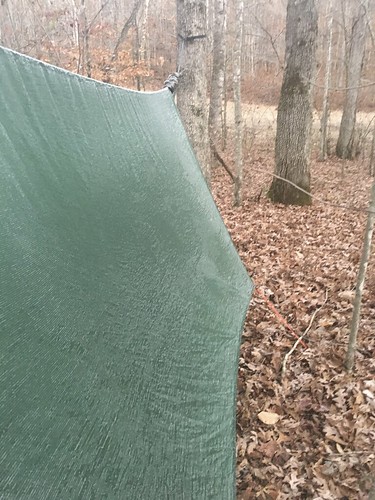
Here’s the frost that was on my tarp the next morning:

Frost on my tarp

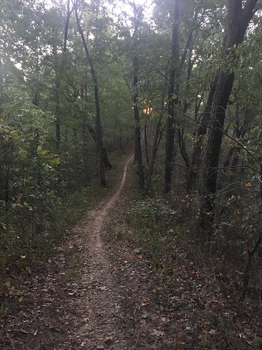
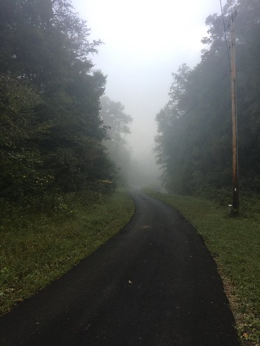
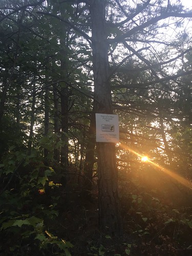
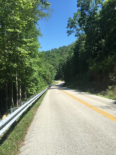
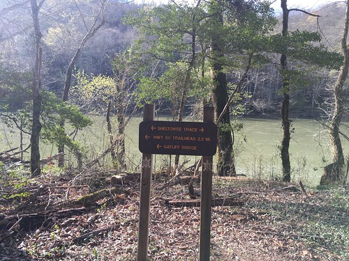
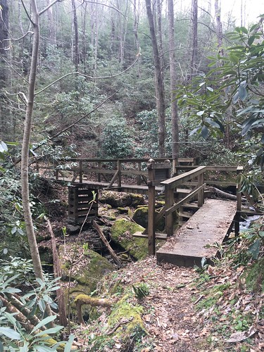
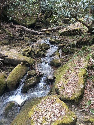
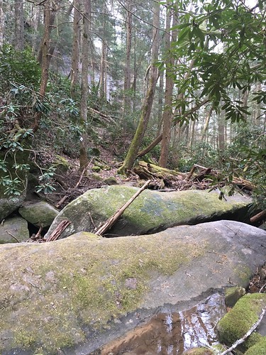
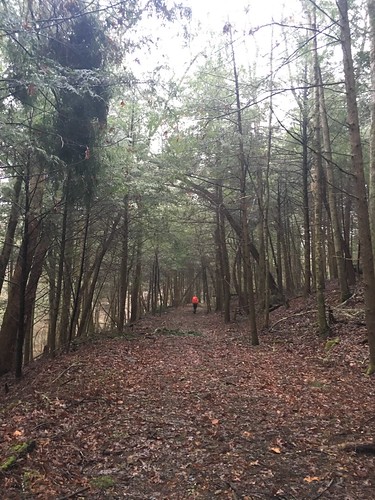
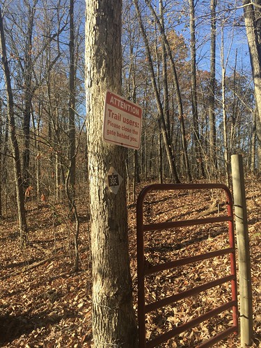
The hike out was fairly uneventful, though we did have to remember to close a couple gates behind us.

Close the gate

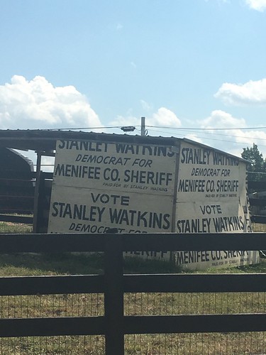
Honestly, I wish I could say I enjoyed the last few miles of this epic hike, but the recent election weighed very heavily on my mind that Sunday. I had some difficulty getting past the anxiety and fear to just zone out and bask in the final miles. Hiking is the best form of free therapy I’ve ever found, and even though maybe it’s never as instantly healing as I’d like, I know it’s always good to exercise my body even if my mind feels frantic.

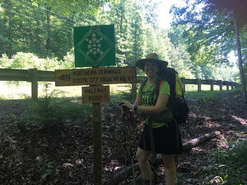
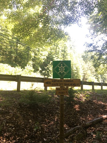
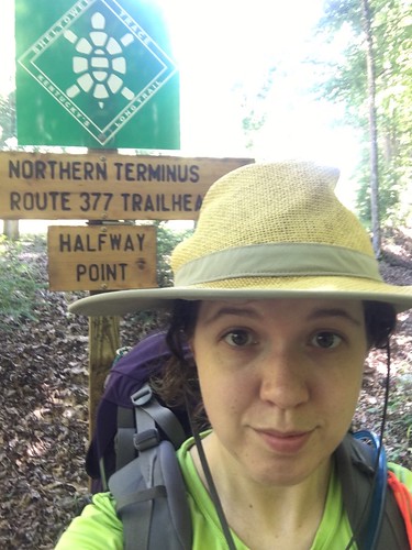
Our trail angels made a reappearance at the end with sandwiches, snacks, and soda. Steve, STA director, was there to shake our hands and congratulate us as we crossed the finish line.

Crossing the finish line

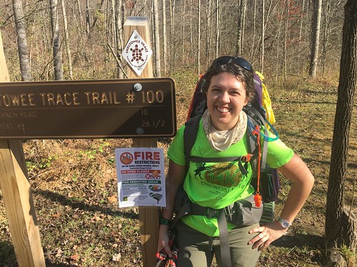
Thank you to the trail angels and Steve for helping us celebrate a joyous occasion. I really look forward to joining everyone down in Livingston for a few weeks so we can all collectively celebrate our huge accomplishment. It’s no small thing to hike over 300 miles in one year. I am so grateful for the connections I made over the last year, and the beauty I got to see every month in this very special part of the country. I’ll be sharing more “closing thoughts” about the Sheltowee Trace. If you are interested in joining the Class of 2017, sign-ups are now open!

Trailhead Parking

Sheltowee Trace Northern Terminus

Susanna and I at the Northern Terminus

Saturday track:

Total distance: 14.81 mi
Download file: section-11-morehead-to-holly-fork-road.gpx

Sunday track:

Total distance: 12.23 mi
Download file: section-11-holly-fork-road-to-northern-terminus.gpx

Sheltowee Trace: Section 10 – Clear Creek trail head to Morehead, KY

Dates: October 8-9, 2016
Weather: Perfect fall hiking weather! Warm but not hot Saturday afternoon, cool in the mornings, and almost chilly overnight.
Section: Clear Creek trail head to Morehead, Kentucky (parking lot across the street from the police station)
Miles: Saturday – 18.08 — Gaia GPS, official STA map — 18ish miles (Readers note that new mileage has been added on to the official ST – if you are looking at a current map, it is Trail 1226 between ST miles 40 and 38.5);
Sunday – 9.97 — Gaia GPS, official STA map — 9 miles (Readers note the first dog-leg on the GPS track below is to Limestone Knob, and the second was to attempt to find the lookout at Amburgy Rock). Scroll to bottom to download GPX tracks for your GPS device or app. The miles displayed in the wordpress plugin are different than what the Gaia app says, which is what I list in this top section. You can also visit my Sheltowee Trace folder on GaiaGPS.

This weekend’s hike started with a valuable lesson – never assume that a campground you’re counting on will have a space when you pull up! Team One was on our own this month for Friday night pre-hike arrangements, so I assumed I could snag a spot at the Twin Knobs campground, only to pull up and find a “campground full” sign at the entrance. To make a long story short, I ended up snagging one of the last few hotel rooms in Morehead, at the Comfort Inn (2650 Ky 801 North) a couple miles away that had just a booking cancellation pop up. I’m eternally grateful to the hotel staff for squeezing me in. It felt a bit like cheating to get a hotel room the night before, but I wasn’t sure if my fellow hikers made it to the other campground (Clear Creek), and since it has no cell phone service, I felt a bit uneasy about that prospect since I was on my own this month.

I brought the stove back this month, along with a bit more weight in food and insulation. I don’t think I added more than a couple pounds of pack weight, and we had gorgeous weather, but for some reason Saturday’s hike was really difficult for me. Apparently I wasn’t the only one – lots of other hikers mentioned the same thing.

Enclosure

Signs of hunting season have begun to pop up near the trail, especially since this section goes through a pioneer weapons hunting area. At one trail junction, I was hiking by myself, and as I looked to see what the marker on the non-ST trail said, I heard a disembodied voice out of nowhere say quietly, “Ma’am, are you looking for your party?” I looked around, and couldn’t see anyone, and began to freak out – until I looked up and saw a hunter in a tree-stand in full camo (no blaze orange on him). All I could think to reply was “Oh, hi! You are very well camouflaged!” I headed on down the trail and saw a couple other guys in tree stands (visible from far away since they were using blaze orange gear).

Pioneer Weapons

David on the trail

Later on, a group of 6 horseback riders passed on the trail. Many of the ST trails are also used by horseback riders, but this was the first time I had actually encountered any. They went much faster than I thought – impressive!

Much of the trail on Saturday went around the Cave Run Lake, and we got a glimpse of fall.

Cave Run Lake

Cave Run Lake

Cave Run Lake

I always enjoy the first bit of hiking on Sunday – I’m often on my own (the last few months, the earliest risers tend to be a few minutes ahead of me, while those who like to sleep in are just waking up as I hit the trail), so I enjoy the solitude and the feeling of the woods waking up around me as I set off for the final miles of the day.

Sunday morning trail

Diamond blaze

On Sunday, I climbed to the top of Limestone Knob, the highest point in Rowan County with a couple other hikers. No good lookout, but there was a neat survey marker on top. I also tried to figure out the Amburgy Rock lookout, and gave up after a few minutes of trying to find the best way up.

Survey marker on top of Limestone Knob

Turtle post

The last few miles on Sunday were road-walking back into Morehead. I have a very strong affinity for Morehead – it always feels like something is going on there, and I love how it’s tucked in to the foothills. With our arrival in Morehead, we now have less than 25 miles to go with our final hike next month.

Turning on to Mill Branch Road

Mill Branch Road

Telephone Pole

Crosswalk into Morehead

West Side Storage

Finally, a huge thank you to Elizabeth, Class of 2015, who helped with Team One support this weekend while STA director Steve was at a trail conference. She did an awesome job bringing us water along the trail and checking us all in.

Saturday track:

Total distance: 18.64 mi
Download file: section-10-clear-creek-to-mile-33.gpx

Sunday track:

Total distance: 10.22 mi
Download file: section-10-mile-33-to-morehead-kentucky.gpx

Sheltowee Trace: Section 9 – Highway 715, near the Red River Gorge suspension bridge to Clear Creek trail head

Dates: September 10-11, 2016
Weather: Hot and clear. Rain storm on Saturday night.
Section: Highway 715, near the Red River Gorge suspension bridge to Clear Creek trail head
Miles: Saturday – 16.88 — Gaia GPS, official STA map — 16 miles (Readers note that the track has a weird dog leg at the beginning — I think the satellite didn’t lock on to the correct position when I began recording, but it didn’t appear to affect the mileage);
Sunday – 13.3 miles — Gaia GPS, official STA map — 12.25 miles. (Readers note that my GaiaGPS mileage on Sunday was slightly higher than it should have been due to getting briefly lost.) Scroll to bottom to download GPX tracks for your GPS device or app. The miles displayed in the wordpress plugin are different than what the Gaia app says, which is what I list in this top section. You can also visit my Sheltowee Trace folder on GaiaGPS.

I can’t believe we’re almost done – just two months left. We still had some hot weather this month, but not as bad as August. I’m ready for fall weather to get back, though!

Our hike on Saturday started in the midst of a trail running race – luckily we started around Mile 8, and only shared a few miles of the trail with the racers. Still, it can be really disconcerting to have a runner sneak up on you very fast when you don’t have many places to step off the trail. Luckily I only had a couple dozen pass me before the race turned off of our main trail (and apparently, one of the first runners accidentally missed that turn — bummer for him!) I find competitive trail running to be quite a thing to behold – how do people not trip and die?? I’m sure it helps not to be carrying a 25 pound pack, but how do you ensure you don’t roll an ankle when running over some loose gravel? I just can’t imagine traversing trails without my trekking poles, since they save me from at least one serious injury every time I go out on a hike (I am a klutz, so this is not an exaggeration!) Honestly, rock climbing seems far more safe than trail running.

I didn’t take as many pictures on this hike, but I really like the ones I took. There were some great scenes on this hike, especially the spooky-beautiful mist on Sunday morning.

Saying Hi to a Horse

Sunflower Barn Quilt Square

Stanley Watkins for Sheriff

Watering up

I utterly loathe graffiti on the beautiful rock houses/faces around the trail, but if it’s going to exist, at least it should be entertaining. What’s up with “To Hell with Communism”…? Do you think it dates from the Cold War, or was someone reacting to the recent re-establishment of diplomatic relations with Cuba, or…???

To Hell with Communism

On Saturday night, it rained for a couple of hours. I know doing this is a no-no, but I had a bit of bourbon left in my flask, so I kicked back in the hammock, snug and dry beneath the tarp, and finished it off (this is a no-no because normally I am 100000% religious about not having anything food/drink/smelly related in my hammock because of bear safety reasons. But I figured a bear was not going to be venturing out in the storm). At first I thought, I should read this downloaded ebook of Alexis de Tocqueville (nerd alert…) or journal a bit. And then I thought, this is relaxing AF, I should just rock back and forth and enjoy this for-real version of a white noise machine.

Even though the first few miles of Sunday morning was road-hiking, I loved the views because of the mist. I’m not sure if it’s usually like this, or because of the rain the previous night.

Misty morning

Spider web

Road in Mist

Barn Skeleton

I loved seeing this sign for “Foxfire Lane”…! I am a big fan of the Foxfire books (though I know those originate from Georgia), and it’s cool to see other additional references to foxfire around Appalachia.

Foxfire Lane

More Difficult

View in distance

Arch in the distance

Pack it in Pack it out

This was one of my favorite things I’ve seen yet along the trail — cutting switchbacks is a huge pet peeve of mine. Just don’t do it! For you non-hikers, switchbacks are when the trail takes long zig-zags back and forth down a hill. The reason you don’t want to shortcut the switchbacks are because it contributes to erosion. Also, don’t you think this is a good metaphor for life?

No Short Cuts

Just before the end of Sunday’s hike, there was a little side-trip option to a picnic area with the cleanest vault toilets I’ve ever encountered. It was definitely worth the extra 5 minutes off the trail to see this crumbling old iron furnace.

Clear Creek Iron Furnace

Clear Creek Iron Furnace sign

Some closing reflections from this hike…. I’ve been doing a lot of work around climate change as part of my current research. This has involved reading a lot about horrifying things happening to parts of the Earth I don’t get to see, like watching sad and heartbreaking documentaries about glaciers melting at alarming speeds near the North Pole. And as I was hiking, I began to think about why it is that folks mourn more easily for glaciers and polar bears than the threatened treasures in our backyards.

For example, the Eastern hemlocks in the region that the Sheltowee Trace goes through are threatened by the wooly adelgid, which scientists tell us will get worse with climate change. I really, REALLY love the hemlocks along the Sheltowee — it’s amazing to me that a tree can have such tiny little needles and yet grow to be so magnificent. And I extra-love hemlocks, because sometimes they have “peg” like structures coming off the trunk (I assume these are branches that fell off, or were chewed off by deer) that are perfect for hanging things off of while in camp.

I often hang my hammock from hemlocks. Regardless of whatever trees I hang from, whenever I take down my hammock I silently thank the trees that supported me through the night (and sometimes touch their bark) and God for letting me be safe another night on the trail. So the idea that hemlocks could possibly disappear from the Sheltowee…? It would be an utter tragedy. I can barely imagine it, and I don’t let myself think about it for very long.

One of the things that is a real bummer about working in the area of climate change is it’s easy to get discouraged and think “Ugh, we’re all screwed. Humans are the worst, and we’re causing everything that is beautiful and lovely in the world to die in horrible numbers.” And while on the one hand that’s true whether we want to believe it or not, I also don’t think it’s a helpful way to move forward through life with a sense of purpose. Wallowing too much in how badly we’ve screwed up can be paralyzing and defeatist. I read an essay earlier today by playwright Tony Kushner titled “Despair is a lie we tell ourselves.” And it’s true — if you succumb to despair, that things are spoiled beyond salvation, you let yourself off the hook for doing your part to appreciate what we still have and fight for it. One of my personal mottos is that famous phrase of the late, great Mother Jones: Pray for the Dead, and Fight Like Hell for the Living. And so when I’m on the trail, I feel blessed and thankful to see a little baby hemlock popping up along the side of the path. The best way yet I’ve figured out to counteract the sense of helplessness I can sometimes feel with my research is to get outside (literally. GET. OUTSIDE. AWAY. FROM. SCREENS.) and bear witness to the fact that life is still very much around us, everywhere.

Thank the Lord.

Saturday track:

Total distance: 17.49 mi
Download file: section-9-highway-715-near-rrg-to-clifton-roadcreek.gpx

Sunday track:

Total distance: 13.78 mi
Download file: section-9-clifton-roadcreek-to-clear-creek-trail-head.gpx

Sheltowee Trace: Section 8 – Heidelberg to Highway 715, near the Red River Gorge suspension bridge

Dates: August 13-14, 2016
Weather: Hot and clear
Section: Heidelberg, Kentucky (just across the blue bridge) to Highway 715, near the Red River Gorge suspension bridge
Miles: Saturday – 21.91 — Gaia GPS, official STA map — 20.5 miles (readers note I forgot to activate my app for about 20 minutes during the last leg of Saturday’s hike, so if you look at the track there is a chunk missing);
Sunday – 12.67 miles — Gaia GPS, official STA map — 11.5 miles. Scroll to bottom to download GPX tracks for your GPS device or app. The miles displayed in the wordpress plugin are different than what the Gaia app says, which is what I list in this top section. You can also visit my Sheltowee Trace folder on GaiaGPS.

The section of the Sheltowee Trace around Heidelberg has the mildly horror-inducing nickname “the Heidelberg death march” because it consists of so much road-walking. So for Saturday, we were on the road much of the day, including some steep climbs. In the hot and humid August heat.

Luckily I had the foresight to bring my daypack with me, and was able to slack pack on Saturday (my big pack was in STA director Steve’s van, which I carried on Sunday with my daypack squished inside). This helped a lot, but the day was still very challenging. It’s not called a challenge for nothing! Road walking definitely has more cons than pros, but if I can say anything good about it, it’s that you can go on auto-pilot for long stretches. I don’t normally listen to headphones hiking in the woods because it’s too distracting, but as long as you have the volume turned down enough to hear approaching cars, it’s nice to listen to some tunes or podcasts while on a long uphill road climb (my soundtrack on Saturday was a combo of Lizzo’s Good as Hell and some of the tracks from Beyonce’s Lemonade album).

I took a ton of pictures on this hike. I recently finished Roderick Nash’s Wilderness and the American Mind, which is a foundational history on the rhetoric and theory behind the establishment of protected wilderness. I was also in the middle of reading Erik Reece’s Lost Mountain, which recounts a year-long snapshot of mountain top removal and strip mining in Kentucky. So while we were hiking, I was thinking a lot about how humans shape the environment and how even deep inside the woods you can see the work of humans everywhere (trail markers, signs posted on trees, etc). Because this was my frame of mind during the hike, a lot of the pictures show a combination of nature and civilization.

Shortly after we began the “death march” we stopped by this store where we took a break to drink the official beverage of the state of Kentucky, Ale8. Nothing refreshes better during a hot hike!

The official beverage of Kentucky

Ale8 vending machine

Bear Track

Quilt square

Walking the path

A somewhat surprising thing about this hike was the number of oil wells in the area. We walked by several of them on Saturday’s hike.

Oil and gravel

This was the most punishing uphill climb. These photos are “behind me” and “in front of me” shots of the climb — according to my app, it was over 350 feet of elevation gain in < 20 minutes. Dear Beyonce, thank you for getting me through this very difficult part! Big road walk

Road walk never ends

Oil rig

Sunny afternoon

Field of oil rigs

Before we pushed on through the last leg, we stopped to rest our now very tired legs. Too bad these Ale8 trucks weren’t full of frosty beverages to pass out!

Ale8 trucks

Nature taking it back

Hot road walk

Despite the long road walk, we got to camp with a few hours of daylight left. Folks set up their tents (or hammocks — and this month, I believe the hammock campers may have outnumbered the tent campers by close to 2 to 1) and then congregated near this spot to hang out. We haven’t had a fire for a couple months now — it’s just too darn hot.

Last month I found out fellow hiker Kurt is a cribbage player. So I brought my board and we played a few games between Friday and Saturday night. We also roped his coworker Greg into playing three-person cribbage, a first for me.

Relaxing at camp

Cribbage

Sunday morning we were back in the woods, though the first part was pretty brushy. As we approached the Red River Gorge area, we encountered more signs of land management, such as these barriers to offroad vehicles. The sunrise was gorgeous, and I even encountered a living symbol of the trail, this semi-freaked out box turtle!

Barriers

Kentucky conservation plate

Sunrise

Close up turtle portrait

Turtle

Survey marker

Signs in the woods

Fence

Woods view

Good morning!

Morning sky

It was a hot and humid morning, and when I stopped at the Hemlock Lodge in Natural Bridge State Park to unpack some snacks, my gummy bears turned into this…

Congealed gummy bears

Bridge near Hemlock Lodge

The last few miles felt really long – luckily I knocked them out just before some rainstorms rolled in. And I saw more critters towards the end of the Sunday hike – a black snake slithered across the path, and an injured frog (toad?) was doing loopy circles on the way (thankfully fellow hiker Keely nudged it out of the way!). Unfortunately no pictures of either.

Walking over the highway

Creek steps

RRG Suspension Bridge

It’s really hard to believe we only have 3 months left to go. We’re now officially down to less than 100 miles to go!

Saturday track:

Total distance: 22.88 mi
Download file: section-8-heidelberg-to-mile-87.gpx

Sunday track:

Total distance: 12.99 mi
Download file: section-8-mile-87-to-highway-715-near-rrg-suspension-bridge.gpx

Sheltowee Trace: Section 7 – Elisha Branch Road to Heidelberg

Dates: July 16-17, 2016
Weather: Very hot and clear
Section: Elisha Branch Road at US-421 (near McKee, Kentucky) to Heidelberg, Kentucky (just across the blue bridge)
Miles: Saturday – 18.73 miles — Gaia GPS, official STA map — just under 17 miles;
Sunday – 12.92 miles — Gaia GPS, official STA map — just under 12 miles. Scroll to bottom to download GPX tracks for your GPS device or app. The miles displayed in the wordpress plugin are different than what the Gaia app says, which is what I list in this top section. You can also visit my Sheltowee Trace folder on GaiaGPS.

This was a really straightforward hike — and since I’m trying to hurry up and get this posted before packing up for a conference, it’s going to be a pretty brief post!

I first got interested in the Sheltowee after my friend Claire hiked it last year. When I hung out with her last winter to grill her all about the hike, she told me at some point heading out to the monthly hike becomes semi-routine and not quite as big of a deal as it is during the first few months. I’ve found this to be the case by July — it’s kind of nice in a way. I don’t get worked up about my gear selection the way I did back in the first few months, I just get it together and don’t overthink it.

Saturday highlights:
The trail was pretty well-blazed and easy to navigate. The trail still had plenty of mudholes, but nowhere as bad as Section 6. Not too many tree blow downs. On the whole, it was pretty easy, but the heat was bad enough I had to stop several times in order to rest.

Heidelberg Lock, early morning

Resurgence Cave Creek "Spa"

Resurgence Cave Creek

Mess O' Roots

Succulents on a rock

Rock Wall

We got into camp with several hours to go until sunset, and while hanging around, I found tons of ticks crawling around. Yuck. Luckily managed to brush most of them off. My appetite still disappears almost entirely in the heat.

Ale8, the Official State Beverage of Kentucky

Hikers Relaxing After a Long Hot Day

Home Sweet Home!

Sunday highlights:
Some rowdy dogs started following and yapping at me shortly after leaving camp. Luckily Steve had warned us, and I had my poles ready in case of trouble. I dropped my voice into the lowest possible register and yelled GO HOME!!! and luckily got through the stretch without issue.

Embry Curry marker

Morning Glory

Sunday’s section wasn’t as well-blazed, and the trail got a little hard to find in some spots.

Campsite where the trail gets faint

Landslide

Sometimes the best guidance is at your feet

Luckily I never lost it entirely, and soon enough it was on to the long, hot, and brutal road walk. At least with road walking you can sort of go on auto-pilot, and it was a pretty quiet stretch of road until you hit the left turn on KY 399 to Heidelberg. I’ve previewed the map for August’s section — a lot of roadwalking on a somewhat busy stretch. Let’s hope we hit the road early enough to get the worst over with early!

Stop Sign as Target Practice

Kentucky 399

Heidelberg Bridge

Heidelberg lock, afternoon

I got back to the car, and found several more ticks had crawled underneath my socks. Picked them off, and hit the road back to Cincinnati. Until next time…

Saturday track:

Total distance: 19.99 mi
Download file: section-7-elisha-branch-to-forest-service-3022.gpx

Sunday track:

Total distance: 13.11 mi
Download file: section-7-forest-service-3022-to-heidelburg.gpx

Sheltowee Trace: Section 6 – Wildcat Battlefield to Elisha Branch Road

Dates: June 11-12, 2016
Weather: Hot and clear
Section: Camp Wildcat Battlefield parking lot to Elisha Branch Road at US-421 (near McKee, Kentucky)
Miles: Saturday – 20.06 miles — Gaia GPS, official STA map — 20 miles;
Sunday – 12.1 miles — Gaia GPS, official STA map — 12 miles. Scroll to bottom to download GPX tracks for your GPS device or app. The miles displayed in the wordpress plugin are different than what the Gaia app says, which is what I list in this top section. You can also visit my Sheltowee Trace folder on GaiaGPS.

First things first — our fearless Sheltowee Trace Association director, Steve, recently told us that one of his mapping experts will be doing a presentation at the STA October conference on the mismatch between official map miles, and folks’ GPS devices. In many cases, this probably has to do with elevation issues and possibly walking zig-zag style around the trail. In the case of wearable devices (like a FitBit or GPS watch), the device measurement may not accurately take into account one’s stride.

Section 6 was our first major taste of road-walking — as well as some brutally hot temperatures. I never managed to look at the temperature that day (out of cell service areas most of the weekend), but I think the forecast was in the mid-90s, and it sure felt like it. Much of the trail on this month was shared with dirt bikes, ATVs, and horses, which meant that the trail was very, very muddy and full of standing water in many parts. On the bright side, it meant that the trail never “disappeared” (except for a couple of confusing turns and one creek crossing which required studious map consultation).

Overall, despite the mud, road-walking and some of the noise, I really enjoyed this section. I think it was partly due to the monthly hike being “routine” at this point, a growing camaraderie with the other hikers, all the trees being fully leafed, and a lighter pack load due to the warmer weather and going stoveless. More about that further down!

Beautiful woods

Skull on a log

On Saturday morning, we hit a really important milestone — the halfway point marker of the Sheltowee Trace! I think this is around Mile 162 according the official maps, so I would have thought it would be located a couple miles away (the current trail mileage is 319 miles). Anyone have some insights? Either way, it was a really fun place to stop and take some pictures before we hit a 7 mile stretch of hot and humid road-walking.

I made it to the Halfway Point

Halfway Point

Halfway Point selfie!

KY-490

Blaze at your feet

You’ll notice in that photo I have trail runnners on — there were several things I mixed up on this section. First, I bought trail runners a while ago, and had only day-hiked in them until recently. Since I knew it would be hot and there was a lot of road walking (which always feels awful in boots), I ditched my beloved Vasque boots for this weekend and switched to my Brooks trail runners. I’m a convert, at least for warm months. I’ll be back in the boots once we get back into bad weather.

Second, I recently bought this amazing hiking skirt from a woman who started her own business called Purple Rain Adventure Skirts. It was awesome! I was hesitant to wear it on earlier sections of the trail that required a lot of climbing over logs (read: situations when you really want to wear pants). Luckily there were almost no downed trees blocking the trail on this section. I wear dresses every day to work, so believe it or not I feel more normal in a skirt or a dress than pants. The best thing about this skirt besides the breathable material were the generous pockets, and the fact it never twisted around. I don’t know what kind of sewing magic she did to make that possible, but women’s skirts almost always twist around when you walk long enough in them, and it’s a miracle that this one didn’t. It also kept me from getting overheated on the long day.

Finally, I ditched the stove this time! I was going to re-hydrate some couscous in a bag, but I kind of lost my appetite on Saturday and had to force myself to eat a little bit of food. The only thing I was really worried about missing out on was coffee, but I found that the Starbucks Via Instant Iced Coffee packets were just fine. Like trail runners, I am a total convert to stoveless eating for at least the warmer months. Even though I use a very lightweight alcohol stove, the weight savings were noticeable without the bowls and fuel.

Road Walk on KY-89

So these changes all started with a ‘S’ — shoes, skirt, and stove(less). I think these are now my ‘S’ummer ‘S’avings (weight-wise). I also ditched my underquilt this month and was mostly OK without it. I usually weigh my pack once I pack everything (before and after adding in my Platypus filled with water), and in June I saved about 2.6 pounds of base weight over previous months.

Doesn’t sound like a lot, but when you’re slogging through that road walk shown above, it makes every bit of difference. I definitely felt like it was a physically easier hike than in past months, although at one point on that road I got a bit woozy (mostly due to the sun and not eating enough snacks — I was okay after a brief rest).

Almost hidden trail post

Eroded Rock

Shagbark Hickory

Shagbark hickories are one of my favorite trees. This one was beautiful! Fun fact: 50 West Brewing in Cincinnati has made a beer with shagbark.

Sally Crossing the Creek

Stick Arrow

Sometimes when a turn isn’t obvious, an enterprising hiker in the front will thoughtfully lay down some stick arrows.

Standing Water

Hills

Clouds

Aren’t these hills gorgeous?

Kurt and Tom on the trail

Wildflowers

Not only were there gorgeous hills, and shady trees, but some very nice wildflowers.

Walking up to Raccoon Creek campsite

Half Porch mode

Hard to see, but just past the trees behind my hammock was a tiny little fall. A great place to hang out and get some fresh water.

Hiking out of the creek

Horse Lick Creek sign

The infamous uphill climb out of camp the next day (it really wasn’t *that* bad).

Mud Holes

This mud hole sort of looks like a giant deer hoof print, huh?

Pavers

Some parts of the trail near roads have pavers (not sure if that is the right term), presumably to prevent further soil erosion due to vehicle use.

Daniel Boone National Forest sign near US-421

After this we had another mile or so of road-walking — this was the last good photo opportunity!

Saturday track:

Total distance: 21.67 mi
Download file: section-6-wildcat-monument-to-raccoon-creek-at-mile-149.gpx

Sunday track:

Total distance: 12.41 mi
Download file: section-6-raccoon-creek-to-elisha-branch.gpx

Sheltowee Trace: Section 5 – Highway 192 to Wildcat Battlefield

Dates: May 14-15, 2016
Weather: Almost perfect weather both days! A little bit of periodic drizzle on Saturday.
Section: Highway 192 trailhead lot to Camp Wildcat Battlefield parking lot
Miles: Saturday – 23.06 miles, Sunday – 10.19 miles [Saturday disclaimer: I got a bit lost just after crossing the suspension bridge at Mile 186 (Sinking Creek), and had to backtrack, which added on just over a mile] (scroll to bottom to download GPX tracks for your GPS device or app. The miles displayed in the wordpress plugin are different than what the Gaia app says, which is what I list in this top section. You can also visit my Sheltowee Trace folder on GaiaGPS. Hikers be aware that miles tracked in GPS are usually longer than the miles noted on the official Sheltowee Trace maps.)

Another beautiful section of the Sheltowee! This section also included more road walking than any other section to date. At least we got some beautiful waterfalls at the beginning.

Highway 192 trailhead lot

Waterfall near the start

Bridge near Cane Creek or Pounder Branch

Van Hook Falls

Van Hook Falls selfie

Shortly before we hit this section of (by now, not super obvious) wind-damaged forest, there had been a very confusing fork with no visible blazes. I had been standing around for quite some time trying to figure out what to do next when another hiker (who has been on the ST many times, and carries around some spare blazes) popped back up to let me know the correct way to go. He added a blaze shortly before this section to help prevent further confusion for hikers behind us.

Wind Damage Sign

One of my favorite things about being a year-round hiker is you really appreciate how beautiful the forest gets after everything being leafless and gray for months.

Clear Trail Path

Like other recent sections, this one required keeping the map handy at all times – several places in which the blazing was less than ideal (more so on Saturday; Sunday’s section was well-blazed and easily navigable because of the road hiking at the end) or when the trail went faint meant that I wasn’t always confident of my place. Here you can see where the blaze was somewhat hidden behind some branches. I didn’t see this at first because the trail had grown somewhat faint going around it.

Slightly Hidden Blaze

This section had a lot of dirt bikers riding in the vicinity. We could also hear a nearby drag racing course. It sounded like a car would suddenly drive up on to the trail!

Tread Lightly

Shortly after this suspension bridge at Sinking Creek, I wandered off the trail (and apparently onto private property…) and added a little bit over 1 mile onto my total Saturday mileage. Bummer! And unfortunately it happened because there was not great blazing on the other side of the bridge.

Sinking Creek Suspension Bridge

After getting back on the trail, it popped up shortly afterward into an open field.

Open Field

After what felt like a long time I finally reaching Highway 80, and had started to get a bit anxious about hitting camp before the sun set. Highway 80 is a little intimidating to cross, but luckily there weren’t any blind curves so I was able to scurry across quickly.

Highway 80

Sheltowee Trace sign

Blazes weren’t always obvious on the trees in this section — the old white diamond blazes had been affixed to the trees many years ago, and the trees had started to grow over and around the blazes.

Tree consuming blaze

Shortly after, you cross a very quiet county road. By the time the sun was obviously getting lower in the sky, and while I still had about an hour until sunset, because the hills were pretty tall and the sun had set on the other side of the hill I was on, the light was quickly getting dim. A few folks made it into camp well after sunset — very glad I made it just in time to have a few last minutes of light to hang my hammock. Most of the group camped on the other side of the Hawk Creek suspension bridge.

Sign at Route 1956

We had a semi-leisurely next morning breaking camp, knowing we only had half the mileage of the day before, and the epic treat of getting to stop by a diner! I didn’t really fall into a deep sleep, but I have been enjoying my new suspension, and always find laying in a hammock to be so comfortable compared to sleeping on the ground – especially because my shoulders and legs are usually pretty sore after 20 miles with a big pack.

Hammock Set-up

Breaking Camp

Hawk Creek Suspension Bridge

Rock Wall

The forested part of Sunday’s hike was particularly enjoyable — beautiful weather, clear trail, and a challenging but pretty climb.

Beautiful May Weather

Bearing Tree

Tree Growing Over Blaze

Blaze

This sign was shortly before we hit a restoration area of the Trace.

Help Preserve our Cultural Heritage

After leaving the restoration area, we were on a gravel road down to the diner next to 75. Whenever you see Steve’s (Sheltowee Trace director) van, you know you’re on the right path.

The official Sheltowee Trace van

Crossing over 75 was a little anti-climactic, but still kind of exciting since it’s about 15-ish miles from the half-way point of the entire trail.

Crossing I-75

The last stretch was heading up roads (including one last very steep incline) to an old Civil War site, Wildcat Battlefield.

Old Wilderness Road

Signage near Wildcat Battlefield

Saturday track:

Total distance: 24.29 mi
Download file: section-5-highway-192-to-hawk-creek-bridge.gpx

Sunday track:

Total distance: 10.52 mi
Download file: section-5-hawk-creek-bridge-to-wildcat-battlefield.gpx

Sheltowee Trace: Section 4 – 700 trailhead lot to Highway 192

Dates: April 9-10, 2016
Weather: Clear and cool on Saturday, clear and late afternoon drizzles on Sunday
Section: 700 Trailhead lot near Indian Creek to the Highway 192 trailhead lot
Miles: Saturday – 15.59 miles, Sunday – 17.31 miles [Sunday disclaimer: I got a bit lost around the marina and backtracked a couple times, which added on probably a half-mile to mile] (scroll to bottom to download GPX tracks for your GPS device or app. The miles displayed in the wordpress plugin are different than what the Gaia app says, which is what I list in this top section. You can also visit my Sheltowee Trace folder on GaiaGPS. Hikers be aware that miles tracked in GPS are usually longer than the miles noted on the official Sheltowee Trace maps.)

This is going to be a picture-heavy and text-lite post, for a handful of reasons:

  • It was a beautiful section with pretty good weather
  • Less mileage this month meant more time to stop and enjoy the scenery
  • I’m in the final countdown to my wedding (this Sunday! yes, I went on a hike the week before my wedding, and I don’t regret it for a second) so I really want to get this out before we enter full-on wedding mode.

For much of the day the trail followed the Cumberland River. For the first part, it was on our right. Unfortunately the first couple miles had a lot of trash, I suspect due to flooding/previous high water levels.

Near the beginning of the trail

Soon we crossed a bridge, and the river was on our left.

Bridge Across the Cumberland River

Occasionally the Sheltowee turtle blazes are not in front of you, but at your feet!

Sometimes the blaze is at your feet

There was a snack bar at Cumberland Falls that we all stopped at, and I went over to look at the falls.

Cumberland Falls

After the falls, the trail heads back into the woods with lots of beautiful scenery on the way to the shelters.

Old Trail Sign

Occasionally nature is interrupted by something a bit more man-made…

Pipe in the Forest

Drips

At one point, the Sheltowee is briefly re-routed away from the edge of the river. Here’s the reroute sign.

Sheltowee Trace Small Re-Route

Cumberland River

Rock House

Leaning Rock

The Sheltowee Trace is full of colorful place names — like Dog Slaughter Falls. But sometimes it’s better not to think too much about how they might have gotten those names!

Trail Sign

Small Falls

Bridge near Dog Slaughter Falls

Dog Slaughter Falls

There were tons of beautiful sweet little wildflowers out on this hike. Here was some purple trillium:

Purple trillium

One of my favorite things about the Sheltowee Trace is the consistent dramatic rock formations.

Look up

Tetris Rocks

The first Adirondack-style shelter is Star Creek shelter. Some of us stopped there to rest out legs for a few minutes and to have a snack.

Star Creek shelter

We don’t often see critters on our hikes (probably too many of us crashing around making noise!), but we do see their evidence everywhere, including beaver cuttings:

Beaver Cuttings

Two miles later we got to Bark Camp shelter. Don’t you love the old-school Leave No Trace sign?

Bark Camp shelter

Pack It In Pack It Out

Sunday morning brought some scrambling to get out of camp — there is a very steep and eroded climb up Bark Camp. Shortly after that there is a big bridge (despite what the ominous sign 5 miles back at Dog Slaughter Falls warns, the bridge is in excellent condition – the only scary part is getting up the hill to it!).

David on the big bridge near Bark Camp

A number of folks got a bit turned around at this point — when you get off the bridge, turn left to stay on the Sheltowee!

Trail sign

In addition to the wildflowers, there were tons of fiddlehead ferns out:

Fiddlehead ferns

Rock walls

Sunday morning selfie

Angular clifflines

Hiking the Challenge with a friend is always a different experience than hiking it by yourself. They both have their pros and cons, and I enjoy both in such different ways it’s not totally fair to compare them. And anyway, you’re never truly “alone” during an entire weekend, you inevitably end up hiking a little while with others and then drifting apart and leap-frogging again, then finally seeing them at camp, which I really enjoy. I definitely missed Susanna’s presence this weekend. At the same time, because I was on my own a week before my wedding, I also enjoyed a few moments of deep reflection I’m not sure I would have had otherwise. One of them happened at this pretty bridge over a babbling brook, and I stopped for a few moments to bask in gratitude for the beautiful day, good health, and getting to marry Justin.

Pretty bridge

Babbling brook

At the mouth of Laurel, the trail goes down to the end of the road. I never get tired of the font on the National Forest Service signs. If the NFS ever attempts to change it, I’m pretty sure I will start the nation’s biggest petition drive.

My favorite font

I have a bumper sticker on my car that says “Archivists make it last longer” but I think this car beats it in terms of immature occupational humor:

Coal Miners Do It On Top

When the trail goes back into the woods, you go through a small area that’s covered with kudzu. Some ST volunteers have done a good job cutting it back so we could get through.

Kudzu

White Trillium

Another aspect of hiking on your own is the need to be extra vigilant in situations where you could lose your footing. Here’s a good example — this is actually a rocky stream crossing. I probably could have crossed on foot, and may have if someone was with me at that moment, but I was worried about losing my footing on the big angled boulders. So I engaged in probably my favorite way of getting around precarious areas — scooting around on my butt. You look silly, but more importantly you stay safe!

A tricky and rocky creek crossing

I love that this section had both old paint blazes and new sign blazes, sometimes right next to each other:

Paint blaze and new blaze

After a few miles, you get a glimpse of the Laurel River spillway. Shortly after that is the dam.

Spillway in the distance

After the dam I didn’t take as many pictures — I had a pretty heavy pack that weekend (carrying tons of insulation for the chilly Saturday night in my hammock), and by this time I was getting tired and my pace was slowing considerably. Also, hikers take note — after the Laurel River dam, the trail is hardly blazed. At one point, I kept moving towards the marina, when I should have taken a left (if you look at the Sheltowee Trace map, it’s around mile marker 203).

I got a little off kilter finding my way back to the trail, so I called Steve and Laura for help. They came out to find me, and of course I was only about 100 yards from the trail. Thanks to them for keeping me sane.

Fancy boats

4 miles from the end

The rest of the hike was fairly pretty, but I had to keep my map handy since there were a couple of spots that weren’t blazed well.

Storybook bridge

This is a good example of a confusing area — at one point the trail pops out of the woods, and to the left there’s a hill, and to the right there’s a sandbar across Ben Branch of the lake. It’s not obvious, but go to the left up the hill.

Go up this path to stay on the Sheltowee!

There are many mountain bikers around this section, and this must be a joke among them. I thought it was amusing.

Honeybun Hill

I look forward to seeing everyone next month after getting married to my favorite dude — in the mean time, since he’s not much of one for backpacking, here’s a picture of us day-hiking at Hocking Hills last summer.

Eira and Justin at Hocking Hills

Saturday track:

Total distance: 16.46 mi
Download file: 700-trailhead-lot-near-indian-creek-to-bark-creek-shelter.gpx

Sunday track:

Total distance: 17.82 mi
Download file: bark-creek-shelter-to-highway-192.gpx

Sheltowee Trace: Section 3 – 6 miles past Peters Mountain Road to 700 trailhead lot

Dates: March 12-13, 2016
Weather: Clear, sunny and warm on Saturday, clear and on/off cloudy/sunny with a couple hours of rain on Sunday
Section: 6 miles past Peters Mountain Road to Big Creek Road Crossing (and Saturday overnight at Flat Rock Baptist Church) to the 700 Trailhead lot near Indian Creek
Miles: Saturday – 25.7 miles, Sunday – 18.1 miles (scroll to bottom to download GPX tracks for your GPS device or app. The miles displayed in the wordpress plugin are different than what the Gaia app says, which is what I list in this top section. You can also visit my Sheltowee Trace folder on GaiaGPS. Hikers be aware that miles tracked in GPS are usually longer than the miles noted on the official Sheltowee Trace maps.)

With the March Section 3 hike, we’re now completely out of Tennessee and bidding a fond farewell to the wild and gorgeous Big South Fork. We will be in the Daniel Boone National Forest for most of the remaining sections. This hike we slack-packed – we didn’t need a tent or hammock because Flat Rock Baptist Church, right on the Sheltowee Trace, hosted us on Saturday night. In addition, we’re all allowed to drop 5 pounds of gear (this happens monthly), so I was able to hike with just my day pack. I really appreciated losing over 10 pounds (!) of gear weight – it made our very long mileage much more manageable.

Also, this was my friend Susanna’s last hike on the Sheltowee for some time. She is heading to California next month to begin her thru-hike the Pacific Crest Trail! I will really miss her company, both in town (she and I live about 10 minutes from each other) and on the trail. You can follow her journey on her blog.

We had perfect weather on Saturday – sunny, clear, and not too hot. We had some beautiful views during the first couple hours of the hike, and then when we descended towards Yamacraw Bridge, we began seeing an exciting sight – abandoned mines! But these are very dangerous, so one MUST keep a respectful distance.

Mine entrance

Trail sign

We had a pretty big creek crossing at Rock Creek, and found a couple of creepy things past the creek – this mystery skull (dog? fox?) and a severed deer leg. Sorry, no pictures of the latter. The skull picture is from Susanna.

Susanna crossing Rock Creek

IMG_1417

A mile-ish later, we ended up at the tiny general store just before Yamacraw Bridge. A sandwich and ice-cold Ale8 was just $4. We continued on, and the trail hugged the river much of the remainder of the afternoon.

Big Boulders

View from Yahoo Falls

The name of the game with the challenge so far has been to learn to be flexible. Saturday was a great example of this – a number of us (including Susanna and me) were pulled off a few miles before the church because sunset was coming up quick, and for safety’s sake (the trail was faint in some places with many downed trees), it wasn’t a good idea for us to walk the last 4-ish miles. That meant on Sunday morning, a big group of us started the day’s hike up a few miles earlier than originally planned. While it was still pretty dark (especially because of the clock going forward with daylight’s saving time), we had a big group out together, and I must say it was an awesome example of team work – we did a great job of navigating the trail and many downed trees in the hour before sunrise.

Once the sun was up, the rest of the trail was super easy and delightful! We only took a wrong turn once, and were able to back track fairly easily.

Outside Flat Rock

Wide path

Susanna underneath rock overhang

Orange salamander

The shorter hike on Sunday (even with the made-up miles from Saturday) meant we hit the road a bit earlier – which worked out well, because we ran into very heavy rain on I-75 north back to Cincinnati. I’m not sure if anyone else on the hike has weird pets at home, but when I get home my cat loves to hang out and smell my stinky gear before I get a chance to air it out. Here’s Clem going crazy over my daypack.

Clem enjoying the smelly pack

I want to especially thank the amazing folks at Flat Rock Baptist Church. They opened up their doors to us so we had hot showers, a roof over our heads, and a delicious dinner with an AMAZING array of desserts. I know we all enjoyed their hospitality – truly our trail angels for this section!

Saturday track:

Total distance: 26.63 mi
Download file: 6-miles-past-peters-mountain-to-big-creek-road.gpx

Sunday track:

Total distance: 18.49 mi
Download file: big-creek-road-to-700-trailhead-lot-near-indian-creek.gpx