Eira Tansey

Posts Tagged ‘Big South Fork’

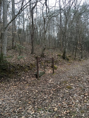
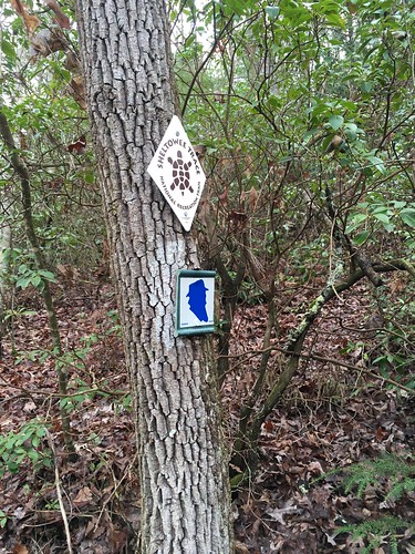
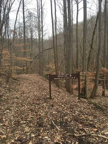
Sheltowee Trace: Section 3 – 6 miles past Peters Mountain Road to 700 trailhead lot

Dates: March 12-13, 2016
Weather: Clear, sunny and warm on Saturday, clear and on/off cloudy/sunny with a couple hours of rain on Sunday
Section: 6 miles past Peters Mountain Road to Big Creek Road Crossing (and Saturday overnight at Flat Rock Baptist Church) to the 700 Trailhead lot near Indian Creek
Miles: Saturday – 25.7 miles, Sunday – 18.1 miles (scroll to bottom to download GPX tracks for your GPS device or app. The miles displayed in the wordpress plugin are different than what the Gaia app says, which is what I list in this top section. You can also visit my Sheltowee Trace folder on GaiaGPS. Hikers be aware that miles tracked in GPS are usually longer than the miles noted on the official Sheltowee Trace maps.)

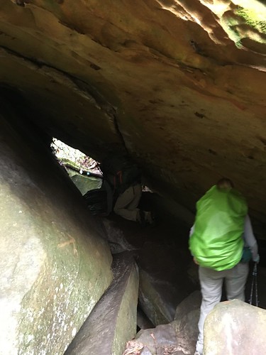
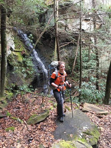
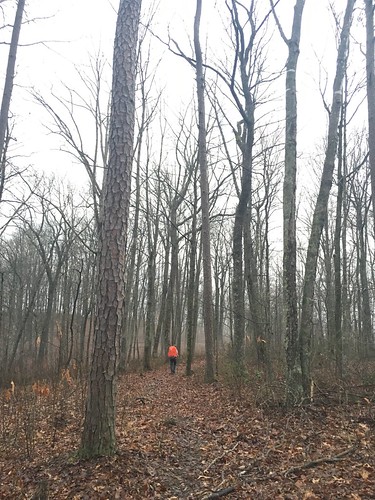
With the March Section 3 hike, we’re now completely out of Tennessee and bidding a fond farewell to the wild and gorgeous Big South Fork. We will be in the Daniel Boone National Forest for most of the remaining sections. This hike we slack-packed – we didn’t need a tent or hammock because Flat Rock Baptist Church, right on the Sheltowee Trace, hosted us on Saturday night. In addition, we’re all allowed to drop 5 pounds of gear (this happens monthly), so I was able to hike with just my day pack. I really appreciated losing over 10 pounds (!) of gear weight – it made our very long mileage much more manageable.

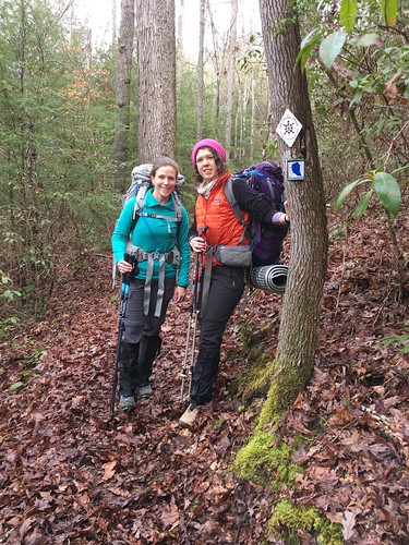
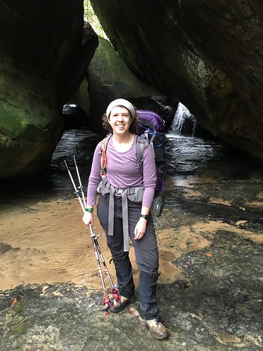
Also, this was my friend Susanna’s last hike on the Sheltowee for some time. She is heading to California next month to begin her thru-hike the Pacific Crest Trail! I will really miss her company, both in town (she and I live about 10 minutes from each other) and on the trail. You can follow her journey on her blog.

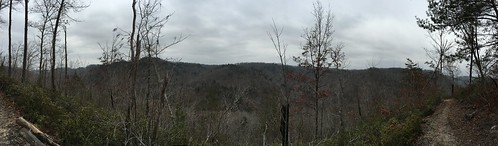
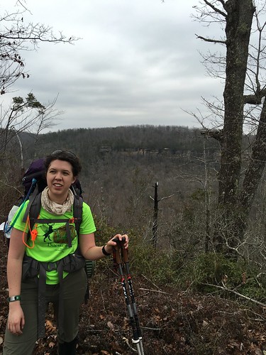
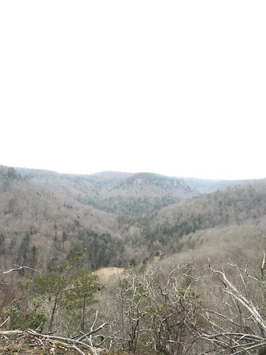
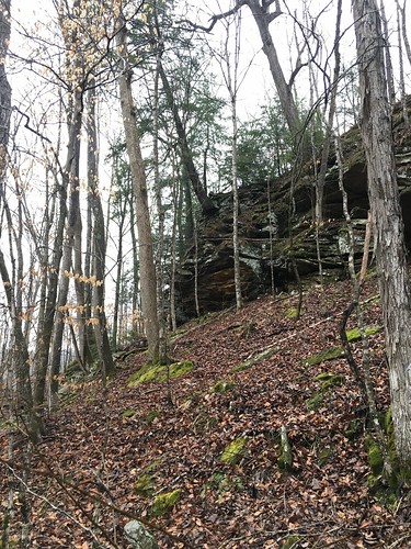
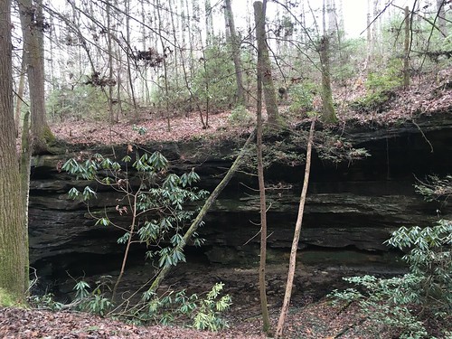
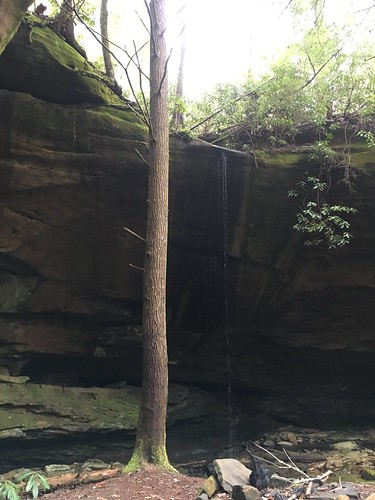
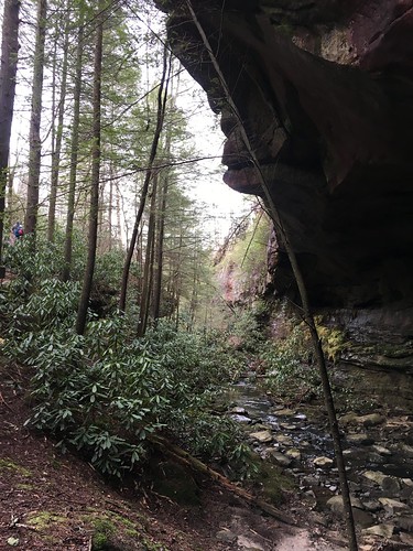
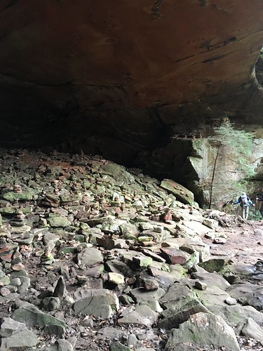
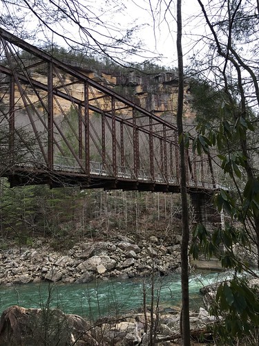
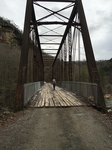
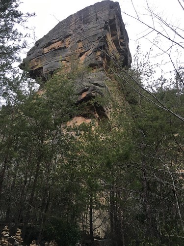
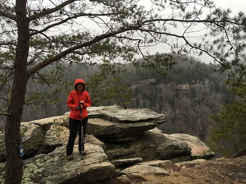
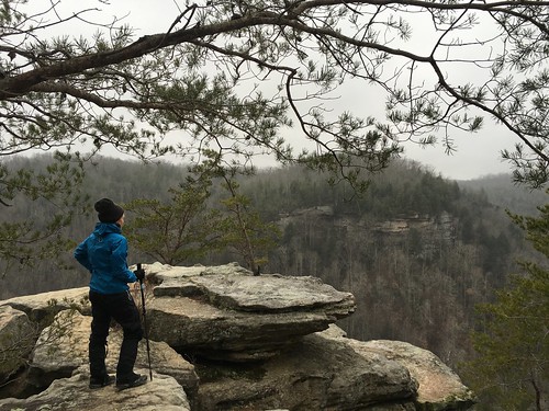
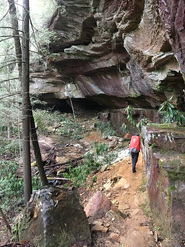
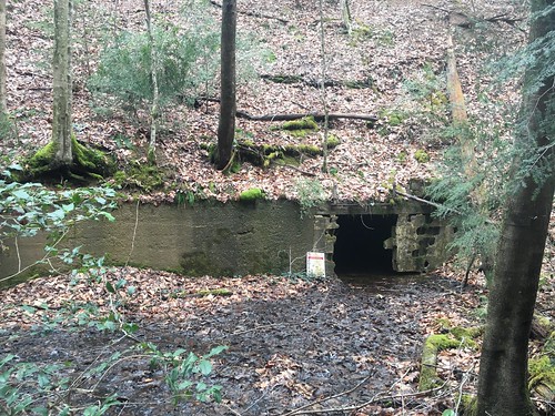
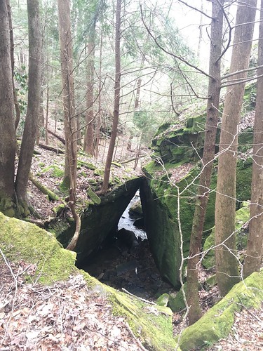
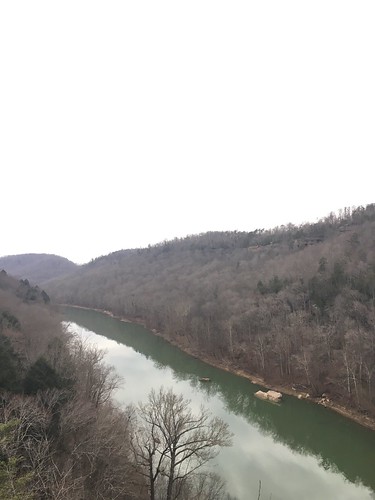
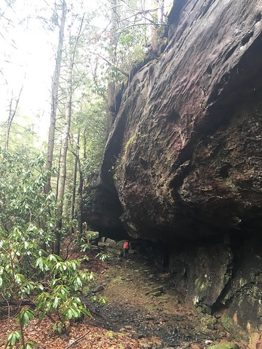
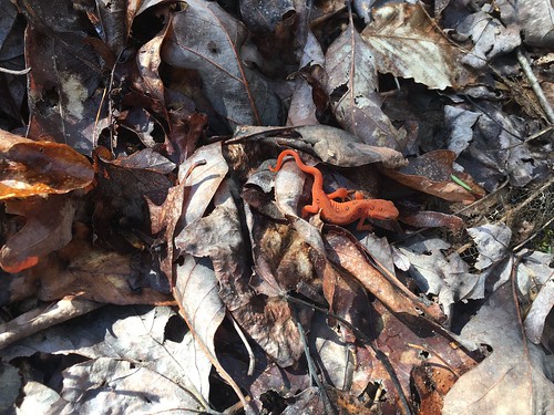
We had perfect weather on Saturday – sunny, clear, and not too hot. We had some beautiful views during the first couple hours of the hike, and then when we descended towards Yamacraw Bridge, we began seeing an exciting sight – abandoned mines! But these are very dangerous, so one MUST keep a respectful distance.

Mine entrance

Trail sign

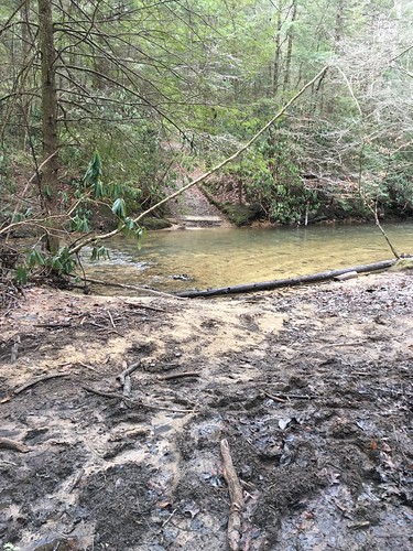
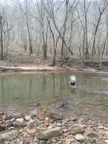
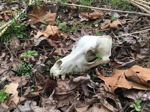
We had a pretty big creek crossing at Rock Creek, and found a couple of creepy things past the creek – this mystery skull (dog? fox?) and a severed deer leg. Sorry, no pictures of the latter. The skull picture is from Susanna.

Susanna crossing Rock Creek

IMG_1417

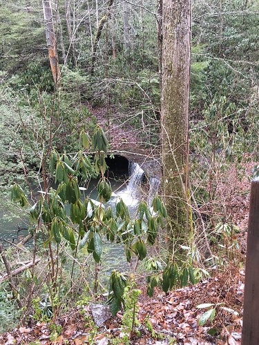
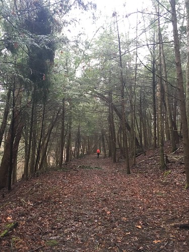
A mile-ish later, we ended up at the tiny general store just before Yamacraw Bridge. A sandwich and ice-cold Ale8 was just $4. We continued on, and the trail hugged the river much of the remainder of the afternoon.

Big Boulders

View from Yahoo Falls

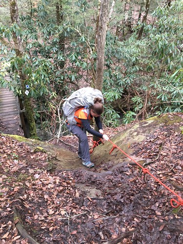
The name of the game with the challenge so far has been to learn to be flexible. Saturday was a great example of this – a number of us (including Susanna and me) were pulled off a few miles before the church because sunset was coming up quick, and for safety’s sake (the trail was faint in some places with many downed trees), it wasn’t a good idea for us to walk the last 4-ish miles. That meant on Sunday morning, a big group of us started the day’s hike up a few miles earlier than originally planned. While it was still pretty dark (especially because of the clock going forward with daylight’s saving time), we had a big group out together, and I must say it was an awesome example of team work – we did a great job of navigating the trail and many downed trees in the hour before sunrise.

Once the sun was up, the rest of the trail was super easy and delightful! We only took a wrong turn once, and were able to back track fairly easily.

Outside Flat Rock

Wide path

Susanna underneath rock overhang

Orange salamander

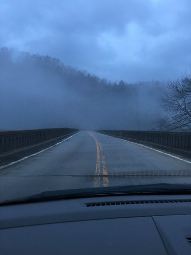
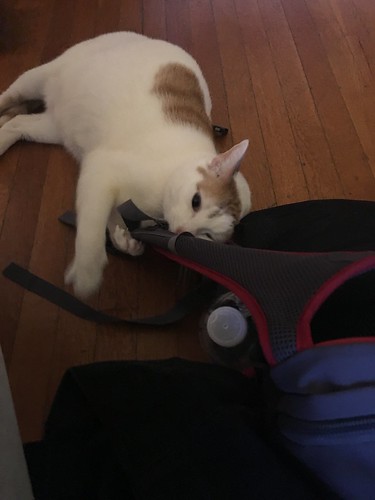
The shorter hike on Sunday (even with the made-up miles from Saturday) meant we hit the road a bit earlier – which worked out well, because we ran into very heavy rain on I-75 north back to Cincinnati. I’m not sure if anyone else on the hike has weird pets at home, but when I get home my cat loves to hang out and smell my stinky gear before I get a chance to air it out. Here’s Clem going crazy over my daypack.

Clem enjoying the smelly pack

I want to especially thank the amazing folks at Flat Rock Baptist Church. They opened up their doors to us so we had hot showers, a roof over our heads, and a delicious dinner with an AMAZING array of desserts. I know we all enjoyed their hospitality – truly our trail angels for this section!

Saturday track:

Total distance: 26.63 mi
Download file: 6-miles-past-peters-mountain-to-big-creek-road.gpx

Sunday track:

Total distance: 18.49 mi
Download file: big-creek-road-to-700-trailhead-lot-near-indian-creek.gpx

Sheltowee Trace: Section 2 – Charit Lodge parking lot to 6 miles past Peters Mountain Road

Dates: February 19-21, 2016
Weather: Clear and perfect weather on Saturday, rain beginning Sunday morning that went on and off most of the day
Section: Charit Lodge parking lot to just across Divide Road (overnight) to 6 miles past Peters Mountain Road
Miles: Saturday – 20.39 miles, Sunday – 15.27 miles (scroll to bottom to download GPX tracks for your GPS device or app. The miles displayed in the wordpress plugin are different than what the Gaia app says. You can also visit my Sheltowee Trace folder on GaiaGPS)

The February section of the 2016 Sheltowee Challenge definitely lived up to the “challenge” part of its name! It was one of those experiences where one moment you’re grateful for the beauty around you, and 10 minutes later you’re cursing the difficulty of the terrain. Team One was originally scheduled to go out the weekend of February 13-14, but frigid temperatures and snow meant rescheduling us over the following two weekends. I decided to join regularly-scheduled Team Two the following week, as did several other members of Team One. Sadly my friend Susanna had a conflict, and she was much missed by the fellow Team One members. This meant that close to 50 hikers hit the trail the weekend of February 20-21!

Swinging bridge

Charit Lodge

Don't miss the turn!

John Muir blaze

Sheltowee blaze

Trail sign

Luckily, the weather was as close to perfect as you could get on Saturday — which was good, because Saturday was the longest I’ve ever hiked in one day: a hair over 20 miles, at least according to my GPS app (I use Gaia GPS for iPhone). We started near Charit Lodge, and the scenery all of Saturday was beautiful! We gained a lot of elevation, but the views were amazing. I think this was at the top of No Business Overlook, but don’t quote me on that.

Beautiful panorama

Me: Exhausted!

Valley

One thing I was really anxious about with Saturday’s long mileage was getting to the campsite before sunset. By the end of the day, I was hiking mostly on my own and leapfrogging other hikers, and I really wanted to make sure I wasn’t caught out there on my own after dark and possibly losing the trail. I kept thinking I was ALMOST there and then of course there was another turn around the bend! By the time I came up to Divide Road (which I knew was there because I could see cars at the top of the hill and knew the campsite was on the other side), I nearly dissolved into tears of relief. Everyone was so exhausted that by the time we were all in camp, I think everyone except for a few people went to bed by 9.

Our fair weather took a turn Sunday morning. Just as I was cooking some oatmeal and coffee under my hammock tarp (I sure do love using a hammock!), I heard a rumble that sounded suspiciously like thunder. Shortly after, the skies opened up, and it rained steadily on and off the rest of the day. One thing I learned from this weekend: when it rains constantly and you’re hiking hard, you’re going to get soaked somehow. Even if you put on rain gear, you’ll inevitably work up a soggy sweat inside your rain coat and pants.

One thing I now appreciate is how winter hiking is incredibly challenging even when it’s mild and there isn’t snow. This is because the trail is incredibly faint in a lot of places, especially when covered with wet leaves. If you were to zoom in closely on my tracks, especially for the beginning of the second day, you’d notice a lot of zigzagging in a few spots. Because of the rain, I didn’t take many pictures but here’s a typical scene — the Sheltowee is full of views like this, with majestic trees growing right out of the rock!

Tree growing out of rocks

By far the hardest part of this trail for me was once it entered Rock Creek (as in, the trail was literally IN THE CREEK). I did this section mostly on my own, and 95% of the time I wasn’t sure if I was doing the right thing (I finally figured out by the time I dead-ended at the waterfall and had to crawl up next to the ladder in dire need of repair that there was no other way forward!). I had done the whole “take the boots off for the first creek crossing and then take forever to put them back on” only to realize I should’ve just kept on my Tevas (which I use for water shoes and for camp shoes) for the next hour or so. Such is life — and while I’m sure I generated beaucoup grit or something during that section, I was also cussing up a storm going through that creek.

The last 6 miles was gravel road walking past the Peter’s Mountain Road campsite, up to where the ST turned back into the woods. Not a super thrilling end, but sort of a good mental break from the hike through the creek. The drive back was super misty, and eerily beautiful!

Mist on the drive home (Yamacraw Bridge)

Every time you go into the woods, you learn a bit more about what worked well and what you can improve on in the future.

What worked well for me:

  • My new alcohol stove is A-W-E-S-O-M-E!!
  • My new sleeping bag was possibly the coziest thing ever. I sleep very cold, so even though the temperature rating was way lower than I needed, I didn’t regret having it.
  • I tried out hiking sock liners under my regular hiking socks — the jury is out until a non-rainy day on blister prevention, but I remain intrigued and they certainly didn’t hurt.
  • I was way better prepared about timing my breaks by stuffing snacks in my hip pockets well in advance.

What I need to improve:

  • I really need to get my act together and change out the default suspension system on my Hennessy hammock. It takes way too long to set up and take down.
  • Even though I got a kitchen scale to weight my various gear, I suspect I’m still carrying too much weight.
  • I’m seriously considering ditching my compass — I know this might be controversial, but it’s the only thing in my gear I’ve never actually used, and it’s not like I’m in seriously remote backcountry. Between a really great set of paper maps with lots of clearly identified landmarks and my GPS app on my phone with an external battery charger, I don’t think I’m at serious risk of getting lost more than a couple hours, especially as I’m very careful to pay attention to blazes and my general location at all times. What do y’all think?

Saturday track:

Total distance: 21.01 mi
Download file: charit-lodge-to-divide-road.gpx

Sunday track:

Total distance: 15.98 mi
Download file: divide-road-to-6-miles-past-peters-mountain.gpx

Sheltowee Trace: Section 1 – Burnt Mill Bridge to Charit Lodge parking lot

Dates: January 9-10, 2016
Weather: Clear and cool on Saturday, rain/snow overnight Saturday into Sunday, below freezing most of Sunday
Section: Burnt Mill Bridge to Leatherwood Ford (overnight) to Charit Lodge parking lot
Miles: Saturday – 14.6 miles, Sunday – 14.2 miles (scroll to bottom to download GPX tracks for your GPS device or app. The miles displayed in the wordpress plugin are different than what the Gaia app says. You can also visit my Sheltowee Trace folder on GaiaGPS)

The Sheltowee Trace is a 319 mile that stretches between Tennessee and Kentucky, with the southern end located in the Big South Fork National River and Recreation Area, passing through the Daniel Boone National Forest, and ending north of Morehead, Kentucky. Every year, the Sheltowee Trace Association (STA) sponsors an annual section hiking challenge that covers the entire trail. Once a month, you hike an average of 28-29 miles (more or less depending on the month, weather, etc) over a Saturday and Sunday. By starting in January and ending in November, you will hike all 319 miles of the Sheltowee Trace.

My friend Claire and her boyfriend did the challenge last year, and over the last year I really enjoyed seeing her monthly uploads of pictures. I did not grow up backpacking, and have only gotten into it over the last year and a half. I’ve been on a few trips through meetup.com, but these have been hit or miss — sometimes they’re quite fun, sometimes not. And more often than not, the trips are cancelled at the last minute. I really wanted the opportunity to get out backpacking on a regular basis, with a group that goes rain or shine. I also like how the Challenge allows participants to hike at their own rate during the day, but camps together as a group at night. There are “sweepers” who hike at the back to make sure no one’s left behind. In early December, I drove down to Livingston, Kentucky (headquarters of the STA) to see Claire and Chris receive their completion certificates at a celebration potluck. I had a great time and was super pumped to start my own challenge the next month.

My friend Susanna joined me for the first section, and she will hopefully be on at least one more before she starts her thru-hike of the Pacific Crest Trail. On the Friday afternoon before the hike, we drove down to Big South Fork, where those getting in early were invited to camp at the Bandy Creek campgrounds. While waiting to set up our gear, some of us early arrivals were highly amused by the “impound shed” — I think this is where the campground hosts impound your gear if you’re a jerk about leaving food out (it’s black bear country) or don’t pay your campsite fees. That night we enjoyed getting to know our fellow hikers, and the weather was quite mild.

Impound Shed at the Bandy Creek campground

The next morning we got up bright and early and drove in the foggy dark to the parking lot near Charit Lodge. We left our cars in the lot, and then boarded a couple of shuttles down to Burnt Mill Bridge. We were on the trail by shortly after 9, and had decent weather all day on the trail. The climb was difficult in some parts because of the constant up-down-up-down.

Susanna and I near the beginning

Blazes

Rock formation

One part of the course was a bit of an obstacle course — we had a rope ladder, and then squeezing through a tight tunnel. There are numerous rockhouses in Big South Fork, and some of them are quite big.

Rope ladder

Waterfall

Rock house

Through the tunnel

After the tunnel

This rockhouse had dozens of cairns inside.

Cairns everywhere

Susanna and waterfall

The final highlight of Saturday’s hike was crossing the O&W bridge. The wooden ties are quite weathered — it’s a bit nerve-wracking to walk over them, I can’t imagine driving over it!

O&W Bridge

Susanna crossing the O&W bridge

As we began to set up camp near Leatherwood Ford, it began to rain. The precipitation turned into some weird rainy-snowy mixture by the time we began packing up early Sunday morning. I had to shake off some frozen rain from my tarp. However, I was mostly snug and cozy in my hammock overnight, except for one or two raindrops that came through (under?) the tarp. While the door kit I brought didn’t work quite as well as I’d hoped (the wind kicked apart the velcro and snapped the fabric edges around), my other accessories kept me toasty (thanks to my mom and mother-in-law for the wool balaclava and the insulated booties).

Note to future campers: At Leatherwood Ford there is a nice big gazebo across from the restrooms. Our group gathered there to cook meals. Susanna showed me how to do some yoga before we turned in, which I think really helped me feel much better Sunday morning (at least until I tripped and banged my knee on a raised step on the way to the bathroom!) But bottom line: do some yoga or at least light stretches before going to bed. It really does help!

By the time Susanna and I hit the trail Sunday morning, the rain/snow had moved off, and luckily it didn’t seem like anything stuck to the ground. The pedestrian bridge across the river at Leatherwood Ford is washed out, so we walked up and crossed over 297. There is a staircase to the right you take down to rejoin the trail.

There were a lot of footbridges on this stretch, and because of the damp weather and the dropping temperatures, we had to be extremely careful not to slip and fall while crossing them.

Frozen footbridge

There is a pretty steep climb a few miles after crossing 297 that takes you up to a lookout called Angel Falls Overlook. This gives you one of the iconic views of the Cumberland River. You definitely have to earn your way there — besides the elevation, there’s a cord bolted to the rock you can hold on to for footing, and a short ladder to go up. Both of these sound terrifying and scary, but I’m a huge wimp and even I could handle them (this guy’s trip report has some pictures). While the weather wasn’t the best, we did managed to get a few pictures of us looking like the brave outdoorsy women we are.

More cairns

Heading up to Angel Falls overlook

Eira at Angel Falls overlook

Susanna at Angel Falls overlook

Susanna at Angel Falls overlook

Susanna on the trail

Waterfall

We kept going until we took a lunch break at the visitor’s center near Bandy Creek. The temperatures were continuing to drop, and I discovered that my gloves situation really needs some improvement. When we got back on the trail after Bandy Creek, the trail was quite muddy since that stretch is also a horse trail. There are not many Sheltowee blazes along this stretch — so few in fact I began to wonder as we passed Blevins Cemetery if we had accidentally taken the wrong trail after not seeing any for around 20 minutes (normally you see a blaze at least every 2-5 minutes). I stopped to pull over and check the maps, and just as I was trying to reassure myself that yes, we were still on the right path, Susanna checked ahead and found a turtle blaze. Phew!

The last bit of Sunday’s stretch really challenged us. We descended a long hill of very loose gravel (I am so grateful to whomever invented trekking poles), and then crossed a shockingly cold creek that required water shoes. Ever go into water so cold it’s like inducing a charley horse in your legs? It was like that. I volunteered myself first (several of us crossed together with the sweepers).

Muddy stream crossing a few miles before Charit

After a few more creek crossings (which we rock hopped to avoid taking off our shoes again), we hustled the last couple miles back to the cars so we could warm up and high-tail it to the closest McDonald’s!

This was a really great section of the Sheltowee — challenging, but definitely enough to leave me wanting more. I’m crossing my fingers the weather will improve in February when we return to the trail. Thanks to STA director Steve Barbour, sweepers Kurt and Cindy (and their trusty German Shepherd Max!), the shuttle drivers from Wilderness Taxi, and our new buddies for a great weekend.

Saturday track:

Total distance: 15.08 mi
Download file: burnt-mill-to-leatherwood-ford-big-south-fork.gpx

Sunday track:

Total distance: 14.54 mi
Download file: leatherwood-ford-to-charit-lodge-parking-area.gpx