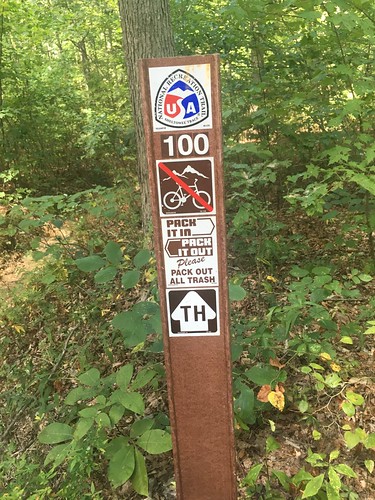
Sheltowee Trace: Section 9 – Highway 715, near the Red River Gorge suspension bridge to Clear Creek trail head
Dates: September 10-11, 2016
Weather: Hot and clear. Rain storm on Saturday night.
Section: Highway 715, near the Red River Gorge suspension bridge to Clear Creek trail head
Miles: Saturday – 16.88 — Gaia GPS, official STA map — 16 miles (Readers note that the track has a weird dog leg at the beginning — I think the satellite didn’t lock on to the correct position when I began recording, but it didn’t appear to affect the mileage);
Sunday – 13.3 miles — Gaia GPS, official STA map — 12.25 miles. (Readers note that my GaiaGPS mileage on Sunday was slightly higher than it should have been due to getting briefly lost.) Scroll to bottom to download GPX tracks for your GPS device or app. The miles displayed in the wordpress plugin are different than what the Gaia app says, which is what I list in this top section. You can also visit my Sheltowee Trace folder on GaiaGPS.
I can’t believe we’re almost done – just two months left. We still had some hot weather this month, but not as bad as August. I’m ready for fall weather to get back, though!
Our hike on Saturday started in the midst of a trail running race – luckily we started around Mile 8, and only shared a few miles of the trail with the racers. Still, it can be really disconcerting to have a runner sneak up on you very fast when you don’t have many places to step off the trail. Luckily I only had a couple dozen pass me before the race turned off of our main trail (and apparently, one of the first runners accidentally missed that turn — bummer for him!) I find competitive trail running to be quite a thing to behold – how do people not trip and die?? I’m sure it helps not to be carrying a 25 pound pack, but how do you ensure you don’t roll an ankle when running over some loose gravel? I just can’t imagine traversing trails without my trekking poles, since they save me from at least one serious injury every time I go out on a hike (I am a klutz, so this is not an exaggeration!) Honestly, rock climbing seems far more safe than trail running.
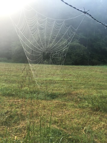
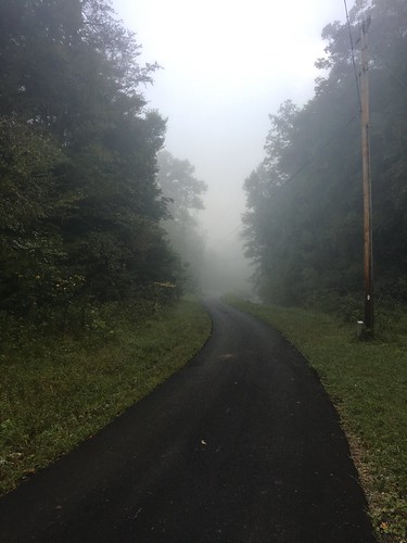
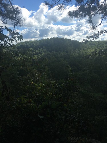
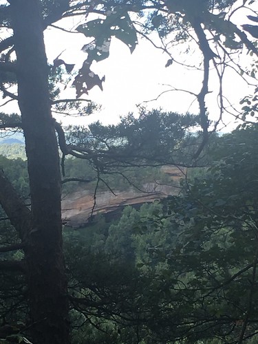
I didn’t take as many pictures on this hike, but I really like the ones I took. There were some great scenes on this hike, especially the spooky-beautiful mist on Sunday morning.
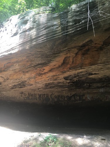
I utterly loathe graffiti on the beautiful rock houses/faces around the trail, but if it’s going to exist, at least it should be entertaining. What’s up with “To Hell with Communism”…? Do you think it dates from the Cold War, or was someone reacting to the recent re-establishment of diplomatic relations with Cuba, or…???
On Saturday night, it rained for a couple of hours. I know doing this is a no-no, but I had a bit of bourbon left in my flask, so I kicked back in the hammock, snug and dry beneath the tarp, and finished it off (this is a no-no because normally I am 100000% religious about not having anything food/drink/smelly related in my hammock because of bear safety reasons. But I figured a bear was not going to be venturing out in the storm). At first I thought, I should read this downloaded ebook of Alexis de Tocqueville (nerd alert…) or journal a bit. And then I thought, this is relaxing AF, I should just rock back and forth and enjoy this for-real version of a white noise machine.
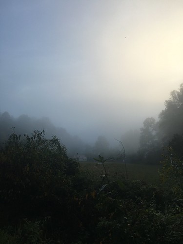
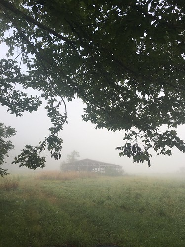
Even though the first few miles of Sunday morning was road-hiking, I loved the views because of the mist. I’m not sure if it’s usually like this, or because of the rain the previous night.
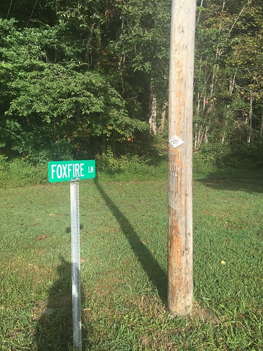
I loved seeing this sign for “Foxfire Lane”…! I am a big fan of the Foxfire books (though I know those originate from Georgia), and it’s cool to see other additional references to foxfire around Appalachia.
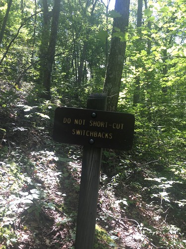
This was one of my favorite things I’ve seen yet along the trail — cutting switchbacks is a huge pet peeve of mine. Just don’t do it! For you non-hikers, switchbacks are when the trail takes long zig-zags back and forth down a hill. The reason you don’t want to shortcut the switchbacks are because it contributes to erosion. Also, don’t you think this is a good metaphor for life?
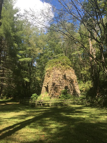
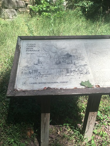
Just before the end of Sunday’s hike, there was a little side-trip option to a picnic area with the cleanest vault toilets I’ve ever encountered. It was definitely worth the extra 5 minutes off the trail to see this crumbling old iron furnace.
Some closing reflections from this hike…. I’ve been doing a lot of work around climate change as part of my current research. This has involved reading a lot about horrifying things happening to parts of the Earth I don’t get to see, like watching sad and heartbreaking documentaries about glaciers melting at alarming speeds near the North Pole. And as I was hiking, I began to think about why it is that folks mourn more easily for glaciers and polar bears than the threatened treasures in our backyards.
For example, the Eastern hemlocks in the region that the Sheltowee Trace goes through are threatened by the wooly adelgid, which scientists tell us will get worse with climate change. I really, REALLY love the hemlocks along the Sheltowee — it’s amazing to me that a tree can have such tiny little needles and yet grow to be so magnificent. And I extra-love hemlocks, because sometimes they have “peg” like structures coming off the trunk (I assume these are branches that fell off, or were chewed off by deer) that are perfect for hanging things off of while in camp.
I often hang my hammock from hemlocks. Regardless of whatever trees I hang from, whenever I take down my hammock I silently thank the trees that supported me through the night (and sometimes touch their bark) and God for letting me be safe another night on the trail. So the idea that hemlocks could possibly disappear from the Sheltowee…? It would be an utter tragedy. I can barely imagine it, and I don’t let myself think about it for very long.
One of the things that is a real bummer about working in the area of climate change is it’s easy to get discouraged and think “Ugh, we’re all screwed. Humans are the worst, and we’re causing everything that is beautiful and lovely in the world to die in horrible numbers.” And while on the one hand that’s true whether we want to believe it or not, I also don’t think it’s a helpful way to move forward through life with a sense of purpose. Wallowing too much in how badly we’ve screwed up can be paralyzing and defeatist. I read an essay earlier today by playwright Tony Kushner titled “Despair is a lie we tell ourselves.” And it’s true — if you succumb to despair, that things are spoiled beyond salvation, you let yourself off the hook for doing your part to appreciate what we still have and fight for it. One of my personal mottos is that famous phrase of the late, great Mother Jones: Pray for the Dead, and Fight Like Hell for the Living. And so when I’m on the trail, I feel blessed and thankful to see a little baby hemlock popping up along the side of the path. The best way yet I’ve figured out to counteract the sense of helplessness I can sometimes feel with my research is to get outside (literally. GET. OUTSIDE. AWAY. FROM. SCREENS.) and bear witness to the fact that life is still very much around us, everywhere.
Thank the Lord.
Saturday track:
Sunday track:
Categorised as: outside
Good write up again? hope too finishing the last two sections on team 1. See you next month
I will definitely be on Team 1 for October, and probably for November too. Looking forward to seeing you again soon, David!