Sheltowee Trace: Section 1 – Burnt Mill Bridge to Charit Lodge parking lot
Dates: January 9-10, 2016
Weather: Clear and cool on Saturday, rain/snow overnight Saturday into Sunday, below freezing most of Sunday
Section: Burnt Mill Bridge to Leatherwood Ford (overnight) to Charit Lodge parking lot
Miles: Saturday – 14.6 miles, Sunday – 14.2 miles (scroll to bottom to download GPX tracks for your GPS device or app. The miles displayed in the wordpress plugin are different than what the Gaia app says. You can also visit my Sheltowee Trace folder on GaiaGPS)
The Sheltowee Trace is a 319 mile that stretches between Tennessee and Kentucky, with the southern end located in the Big South Fork National River and Recreation Area, passing through the Daniel Boone National Forest, and ending north of Morehead, Kentucky. Every year, the Sheltowee Trace Association (STA) sponsors an annual section hiking challenge that covers the entire trail. Once a month, you hike an average of 28-29 miles (more or less depending on the month, weather, etc) over a Saturday and Sunday. By starting in January and ending in November, you will hike all 319 miles of the Sheltowee Trace.
My friend Claire and her boyfriend did the challenge last year, and over the last year I really enjoyed seeing her monthly uploads of pictures. I did not grow up backpacking, and have only gotten into it over the last year and a half. I’ve been on a few trips through meetup.com, but these have been hit or miss — sometimes they’re quite fun, sometimes not. And more often than not, the trips are cancelled at the last minute. I really wanted the opportunity to get out backpacking on a regular basis, with a group that goes rain or shine. I also like how the Challenge allows participants to hike at their own rate during the day, but camps together as a group at night. There are “sweepers” who hike at the back to make sure no one’s left behind. In early December, I drove down to Livingston, Kentucky (headquarters of the STA) to see Claire and Chris receive their completion certificates at a celebration potluck. I had a great time and was super pumped to start my own challenge the next month.
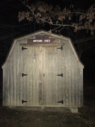
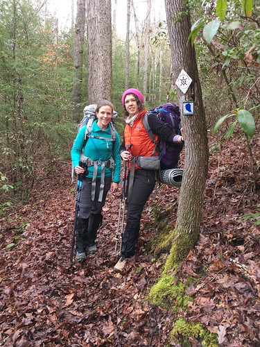
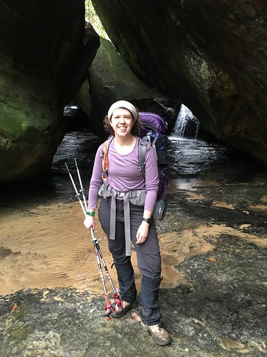
My friend Susanna joined me for the first section, and she will hopefully be on at least one more before she starts her thru-hike of the Pacific Crest Trail. On the Friday afternoon before the hike, we drove down to Big South Fork, where those getting in early were invited to camp at the Bandy Creek campgrounds. While waiting to set up our gear, some of us early arrivals were highly amused by the “impound shed” — I think this is where the campground hosts impound your gear if you’re a jerk about leaving food out (it’s black bear country) or don’t pay your campsite fees. That night we enjoyed getting to know our fellow hikers, and the weather was quite mild.
The next morning we got up bright and early and drove in the foggy dark to the parking lot near Charit Lodge. We left our cars in the lot, and then boarded a couple of shuttles down to Burnt Mill Bridge. We were on the trail by shortly after 9, and had decent weather all day on the trail. The climb was difficult in some parts because of the constant up-down-up-down.
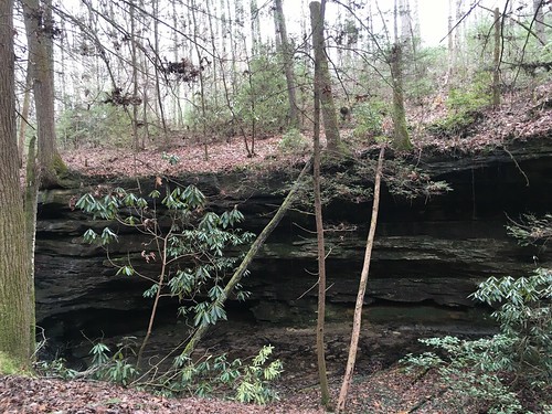
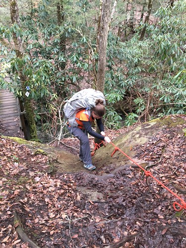
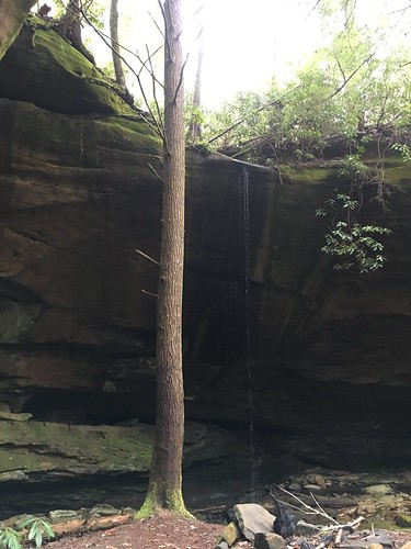
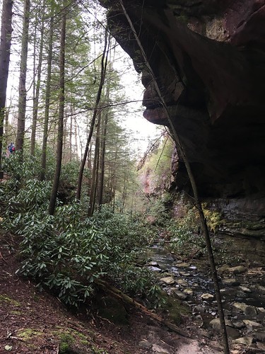
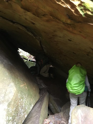
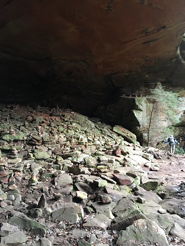
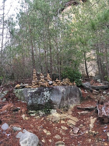
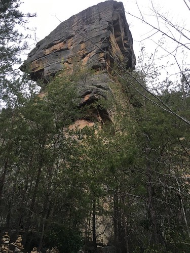
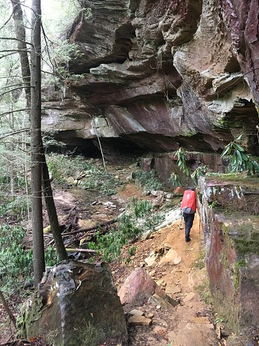
One part of the course was a bit of an obstacle course — we had a rope ladder, and then squeezing through a tight tunnel. There are numerous rockhouses in Big South Fork, and some of them are quite big.
This rockhouse had dozens of cairns inside.
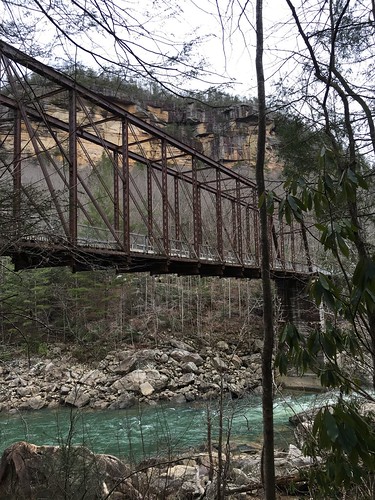
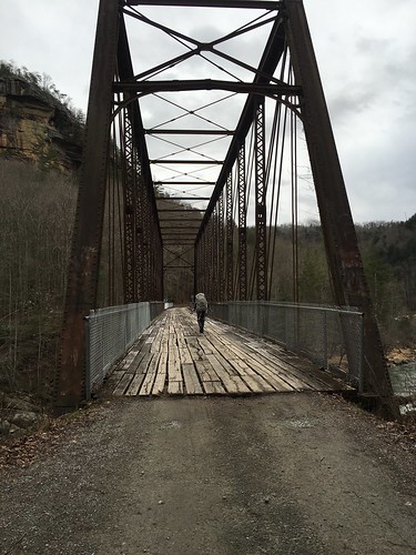
The final highlight of Saturday’s hike was crossing the O&W bridge. The wooden ties are quite weathered — it’s a bit nerve-wracking to walk over them, I can’t imagine driving over it!
As we began to set up camp near Leatherwood Ford, it began to rain. The precipitation turned into some weird rainy-snowy mixture by the time we began packing up early Sunday morning. I had to shake off some frozen rain from my tarp. However, I was mostly snug and cozy in my hammock overnight, except for one or two raindrops that came through (under?) the tarp. While the door kit I brought didn’t work quite as well as I’d hoped (the wind kicked apart the velcro and snapped the fabric edges around), my other accessories kept me toasty (thanks to my mom and mother-in-law for the wool balaclava and the insulated booties).
Note to future campers: At Leatherwood Ford there is a nice big gazebo across from the restrooms. Our group gathered there to cook meals. Susanna showed me how to do some yoga before we turned in, which I think really helped me feel much better Sunday morning (at least until I tripped and banged my knee on a raised step on the way to the bathroom!) But bottom line: do some yoga or at least light stretches before going to bed. It really does help!
By the time Susanna and I hit the trail Sunday morning, the rain/snow had moved off, and luckily it didn’t seem like anything stuck to the ground. The pedestrian bridge across the river at Leatherwood Ford is washed out, so we walked up and crossed over 297. There is a staircase to the right you take down to rejoin the trail.
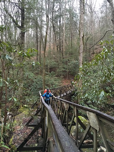
There were a lot of footbridges on this stretch, and because of the damp weather and the dropping temperatures, we had to be extremely careful not to slip and fall while crossing them.
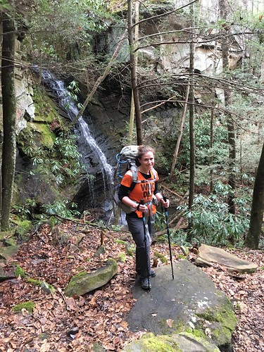
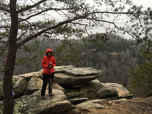
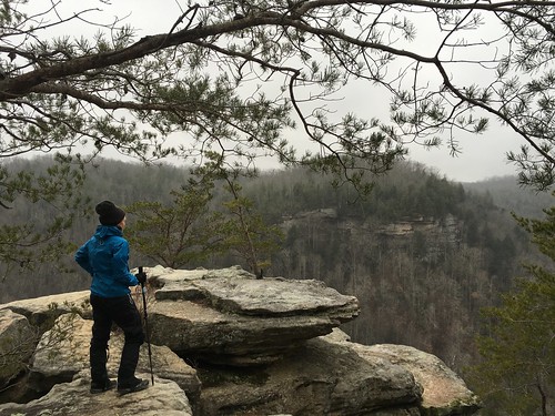
There is a pretty steep climb a few miles after crossing 297 that takes you up to a lookout called Angel Falls Overlook. This gives you one of the iconic views of the Cumberland River. You definitely have to earn your way there — besides the elevation, there’s a cord bolted to the rock you can hold on to for footing, and a short ladder to go up. Both of these sound terrifying and scary, but I’m a huge wimp and even I could handle them (this guy’s trip report has some pictures). While the weather wasn’t the best, we did managed to get a few pictures of us looking like the brave outdoorsy women we are.

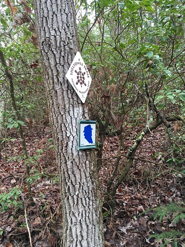
We kept going until we took a lunch break at the visitor’s center near Bandy Creek. The temperatures were continuing to drop, and I discovered that my gloves situation really needs some improvement. When we got back on the trail after Bandy Creek, the trail was quite muddy since that stretch is also a horse trail. There are not many Sheltowee blazes along this stretch — so few in fact I began to wonder as we passed Blevins Cemetery if we had accidentally taken the wrong trail after not seeing any for around 20 minutes (normally you see a blaze at least every 2-5 minutes). I stopped to pull over and check the maps, and just as I was trying to reassure myself that yes, we were still on the right path, Susanna checked ahead and found a turtle blaze. Phew!
The last bit of Sunday’s stretch really challenged us. We descended a long hill of very loose gravel (I am so grateful to whomever invented trekking poles), and then crossed a shockingly cold creek that required water shoes. Ever go into water so cold it’s like inducing a charley horse in your legs? It was like that. I volunteered myself first (several of us crossed together with the sweepers).
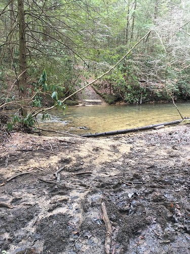
After a few more creek crossings (which we rock hopped to avoid taking off our shoes again), we hustled the last couple miles back to the cars so we could warm up and high-tail it to the closest McDonald’s!
This was a really great section of the Sheltowee — challenging, but definitely enough to leave me wanting more. I’m crossing my fingers the weather will improve in February when we return to the trail. Thanks to STA director Steve Barbour, sweepers Kurt and Cindy (and their trusty German Shepherd Max!), the shuttle drivers from Wilderness Taxi, and our new buddies for a great weekend.
Saturday track:
Sunday track:
Categorised as: outside
I am so impressed
Excellent write up and photos. Thanks.